The main purpose of this ongoing blog will be to track planetary extreme, or record temperatures related to climate change. Any reports I see of ETs will be listed below the main topic of the day. I’ll refer to extreme or record temperatures as ETs (not extraterrestrials).😉
Main Topic: Major Heatwave Laredo Likely to Be Long Lasting for the West
Dear Diary. At this point in time everybody and their mother is writing articles and summaries about Hurricane Helene, which honestly will be the most life threating weather/climate event this week across the United States. I’ll have plenty of links on that item in my Weather Section, as usual. Rather than try to duplicate what’s written about Helene, today let’s concentrate on an early fall western heatwave, which could grow into epic proportions for this time of the year and be another less sexy threat to life besides a hurricane.
The next fossil fuel company name on my list for major heatwaves is Laredo, and I have no doubt that in the cities of Phoenix and Las Vegas, we will see a CAT3 over the weekend. Dangerous heat will probably develop in California over the weekend. Here is my link for heatwave naming and categorization criteria:
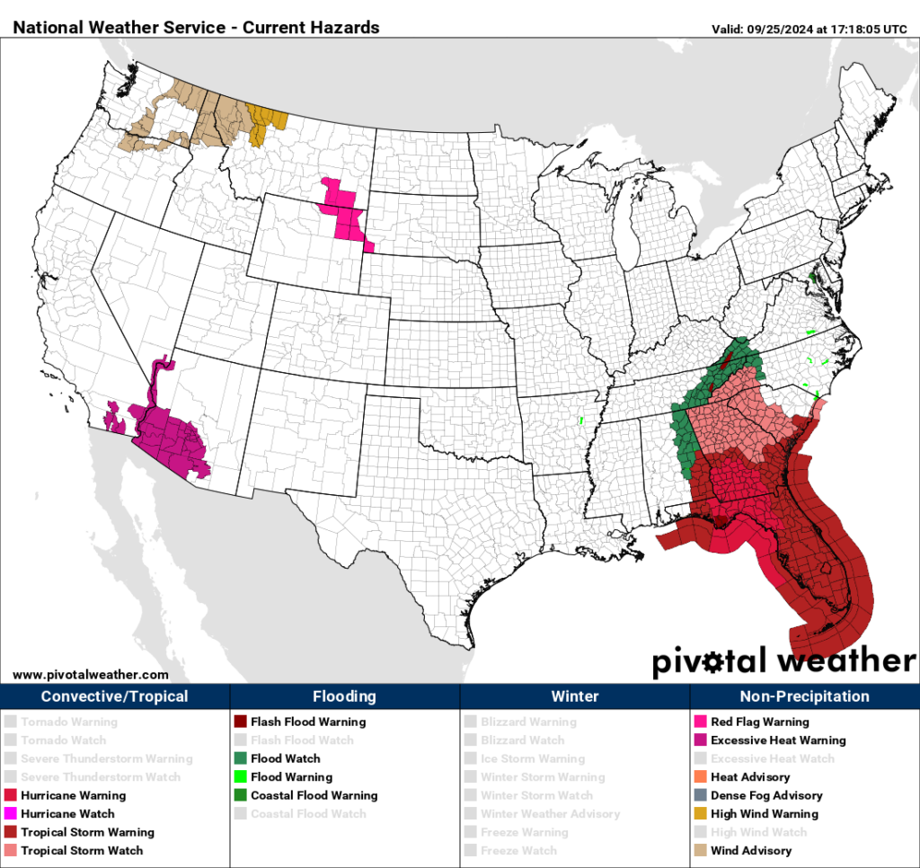
Already we have excessive heat warnings for the Dessert Southwest:

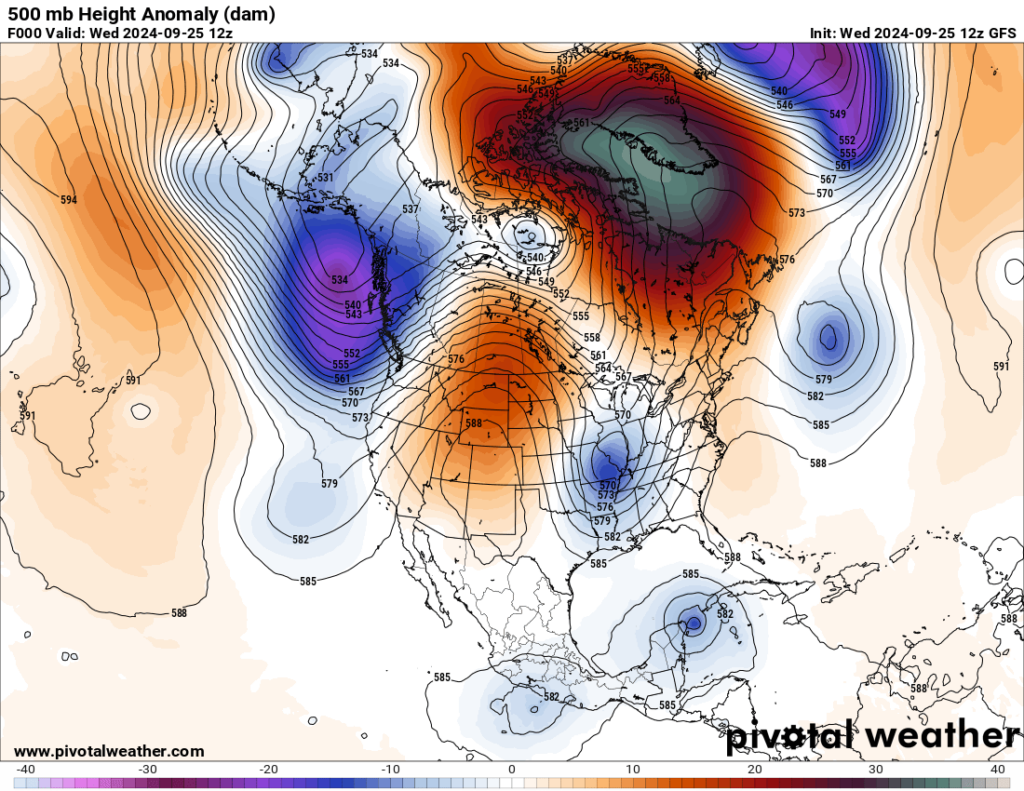
The Southwest is under a “minor” looking heat dome from this morning:

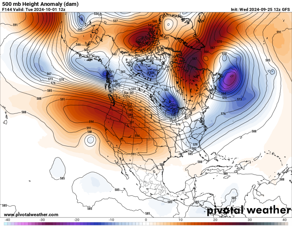
So, as of 9/25/2024 we have a CAT2 heatwave that will close in on major CAT3 status and get the name Laredo by about Friday looking at the forecast heat dome by that time:

This heat dome will only grow in size during next week:

By Tuesday the heat dome should be at its zenith. Will Laredo get to my historic CAT4 level across the West? Stay tuned.
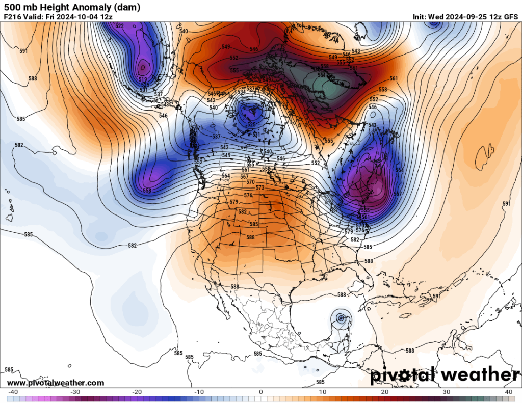
Laredo will be slow to moderate, though, and might spread into the Plains by the end of next week:

We shall see what transpires going into early October as Heatwave Laredo sets a myriad of new records. Speaking of record temperatures:
Here are more “ETs” recorded from around the planet the last couple of days, their consequences, and some extreme temperature outlooks, as well as any extreme precipitation reports:
Here is More Climate News from Wednesday:
(As usual, this will be a fluid post in which more information gets added during the day as it crosses my radar, crediting all who have put it on-line. Items will be archived on this site for posterity. In most instances click on the pictures of each tweet to see each article. The most noteworthy items will be listed first.)