The main purpose of this ongoing blog will be to track planetary extreme, or record temperatures related to climate change. Any reports I see of ETs will be listed below the main topic of the day. I’ll refer to extreme or record temperatures as ETs (not extraterrestrials).😉
Main Topic: Rise of Western Major Heatwave Texaco
Dear Diary. In this day and age of ramped up climate change, we can’t go too long during the heart of summer before another major heatwave rears its hot ugly head across some portion of the United States. This season we saw what I dubbed historic CAT4 Heatwave Shell, which baked the eastern third of the U.S. during the second half of June. By NCEI’s count, 91 all-time records were set by Shell, most of which were all-time high minimums. The most miserable component of Shell was the fact that overnight temperatures did not cool across many locations…many not much below 80°F.
So now it is the West’s turn for a heatwave. Already we have a CAT2 heatwave using my scale of 1-5:
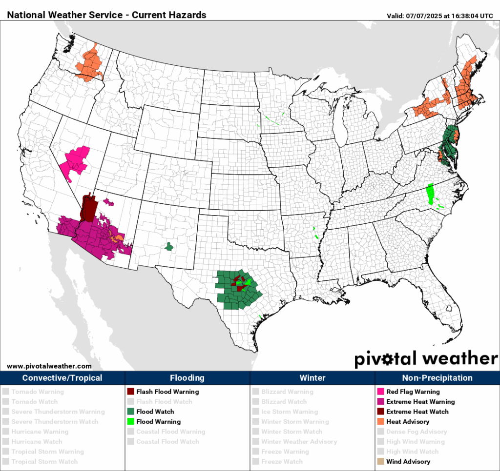
The only reason that the system is not a CAT3 is because of the lack of records across the warned area. Still, levels of heat above 105°F are dangerous:
So, what does the heat dome look like over the system? Here I’ve posted GFS panels valid now and into this coming weekend:
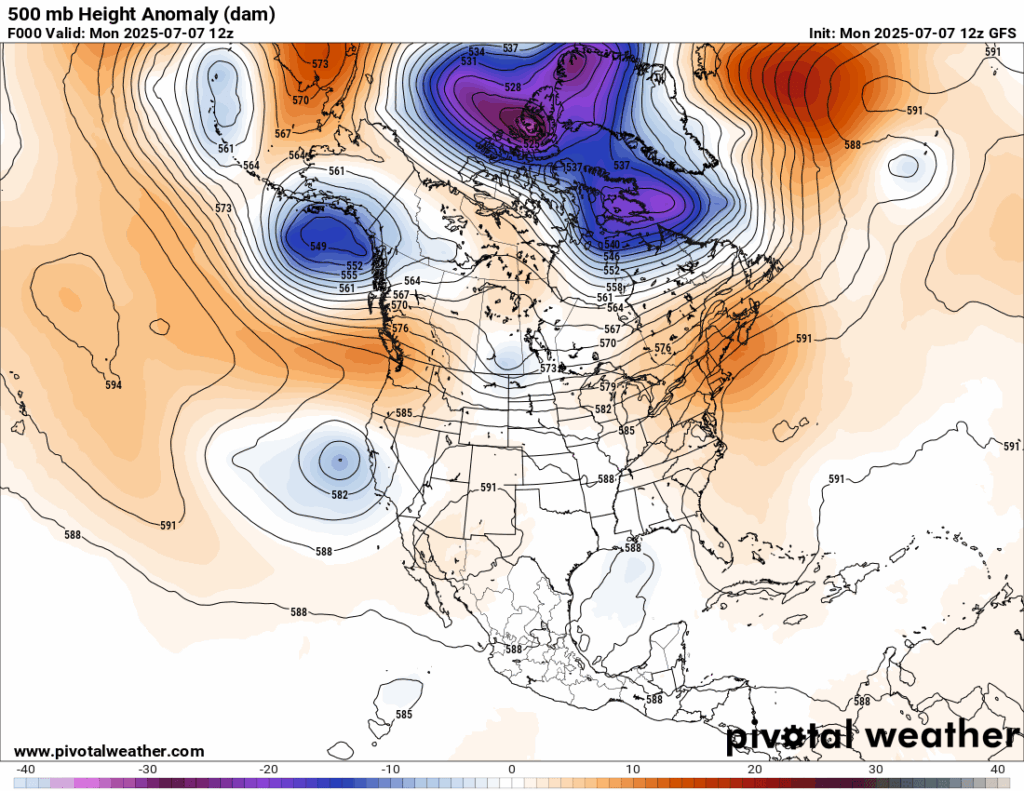
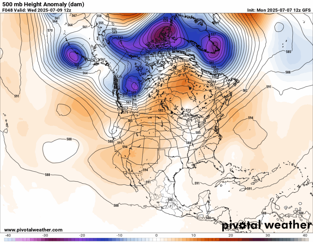
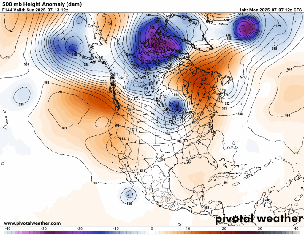
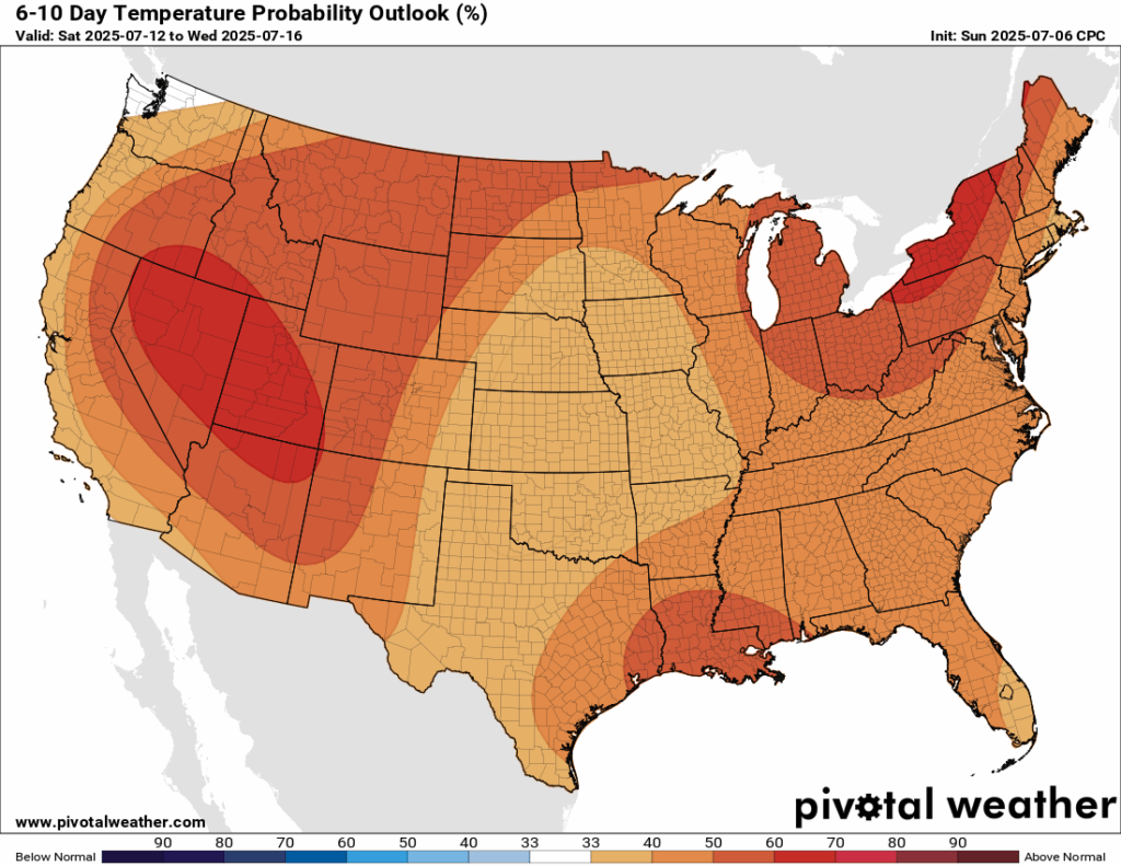
A heat dome grows and persists over the Southwest through next weekend but does not become excessively strong or close to 600 decameters. Also note that 500 millibar heights are above average nearly every location of the CONUS except the Upper Midwest by Sunday. At the surface, we see a forecast of above average temperatures for most of the U.S., indicating that the western heat dome, and high heights elsewhere will persist into the next week:
Looking at guidance, Heatwave Texaco maybe a long lasting persistent big deal. As always, I’ll be posting updates on this site.
Here are more “ET’s” recorded from around the planet the last couple of days, their consequences, and some extreme temperature outlooks, as well as any extreme precipitation reports:
Here is More Climate News from Monday:
(As usual, this will be a fluid post in which more information gets added during the day as it crosses my radar, crediting all who have put it on-line. Items will be archived on this site for posterity. In most instances click on the pictures of each tweet to see each article. The most noteworthy items will be listed first.)