Saturday March 3rd… Dear Diary. The main purpose of this ongoing post will be to track United States extreme or record temperatures related to climate change. Any reports I see of ETs will be listed below the main topic of the day. I’ll refer to extreme temperatures as ETs (not extraterrestrials)😊. Here is today’s main climate change related topic: Blown Away
Aye ya ya…March is notorious for high winds, but this roaring lion is a bit much. We have seem this number before. The Weather Channel has named the current nor’easter Riley. Do you remember Grayson which happened the first few days of this year? Please see my write up about this “cyclone bomb:”
https://guyonclimate.com/2018/01/04/extreme-temperature-diaryjanuary-3-4-2018/
So now we have had two cyclone bombs or nor’easters, which have both been categorized as once in at least a quarter century event. Watt’s (😉) up with that? To refresh your memory of Grayson here is a good graphic:

Now let’s see a fantastic satellite loop of Riley churning off the Northeast coast:
Sunrise on the remnants of a Nor'easter. Reminder: things that spin are pretty. pic.twitter.com/07iR6v1I80
— Dakota Smith (@weatherdak) March 3, 2018
It’s amazing how similar the two systems look. Once more, what do two powerful systems have to do with global warming? The very short answer: Both Grayson and Riley were made more powerful by an anomalously warm surrounding atmosphere and high sea surface temperatures. Has anyone reading this post heard of the Thermal Wind in relation to temperatures from any thermodynamics class? Probably not, but without presenting equations and borrowing from Wikipedia we have this relationship in Physics: https://en.wikipedia.org/wiki/Thermal_wind
“The strongest part of jet streams should be in proximity where temperature gradients are the largest. Due to land masses in the northern hemisphere, largest temperature contrasts are observed on the east coast of North America (boundary between Canadian cold air mass and the Gulf Stream/warmer Atlantic) and Eurasia (boundary between the boreal winter monsoon/Siberian cold air mass and the warm Pacific). Therefore, the strongest boreal winter jet streams are observed over east coast of North America and Eurasia. Since stronger vertical shear promotes baroclinic instability, the most rapid development of extratropical cyclones (so called bombs) is also observed along the east coast of North America and Eurasia.”
The key phrase in the above paragraph is “temperature gradients” in relation to high winds. Essentially, the stronger the temperature gradient around a storm system, the higher the potential for strong winds. The last few days I’ve referred to the polar vortex as being “sick” or running a fever. Now this 500 millibar departure from average panel from Friday is truly feverish:
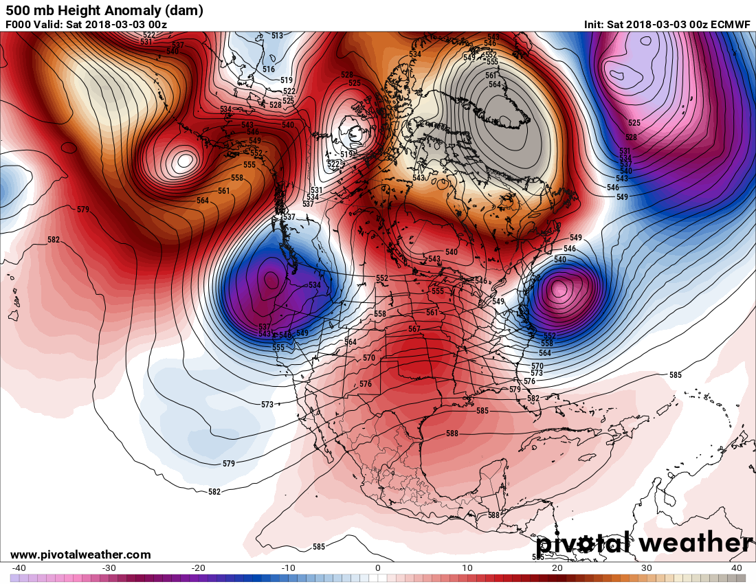
The height anomalies over Greenland are off the scale! It’s no wonder that widespread 70+ mph winds were felt from New England south to Virginia. From my article on Grayson I’ll quote Dr. Michael Mann again:
 Michael E. MannVerified account @MichaelEMann
From the article:
“Surely such a massive winter storm, with its promise of bitter cold winds and potentially heavy coastal snowfalls, must be evidence against the climate crisis?
Once again, rather the opposite is true. East Coast winter storms, known as “nor’easters” because of the unusual northeasterly direction of the winds as the storm spirals in from the south, are unusual in that they derive their energy not just from large contrasts in temperature that drive most extratropical storm systems, but also from the energy released when water evaporates from the (relatively warm) ocean surface into the atmosphere.
This is a characteristic that these storms share with tropical storms and hurricanes. The warmer the ocean surface, the more energy that is available to intensify these storms. And the warmer the ocean surface, the more moisture there is in the atmosphere – moisture that is available to form precipitation. As the winds wrap around in a counter-clockwise manner, they bring all of that moisture northwest, where it is chilled and ultimately falls not as rain but snow. Lots of snow.”
So, during the winter after Grayson exited the scene did the anomalously warm sea surface temperatures cool off the Eastern Seaboard? The short answer: nope.
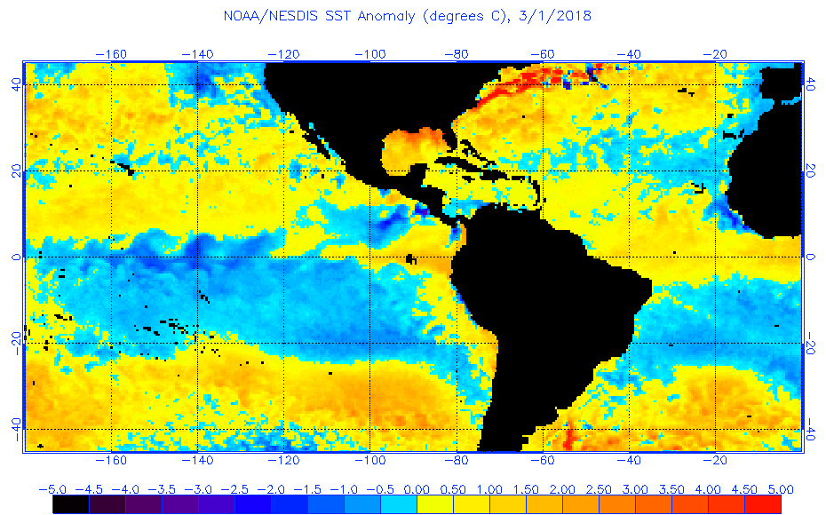
Yes, Riley had plenty of warmer than average sea surface temperatures for strengthening. I’m blown away by some of these stats:
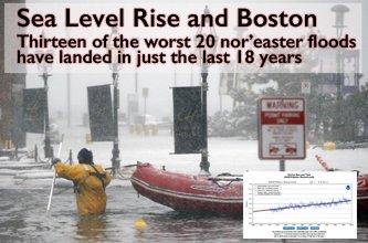
13 of the worst 20 nor’easter floods on record have landed in just the last 18 years.
h/t @EricHolthaus #Riley
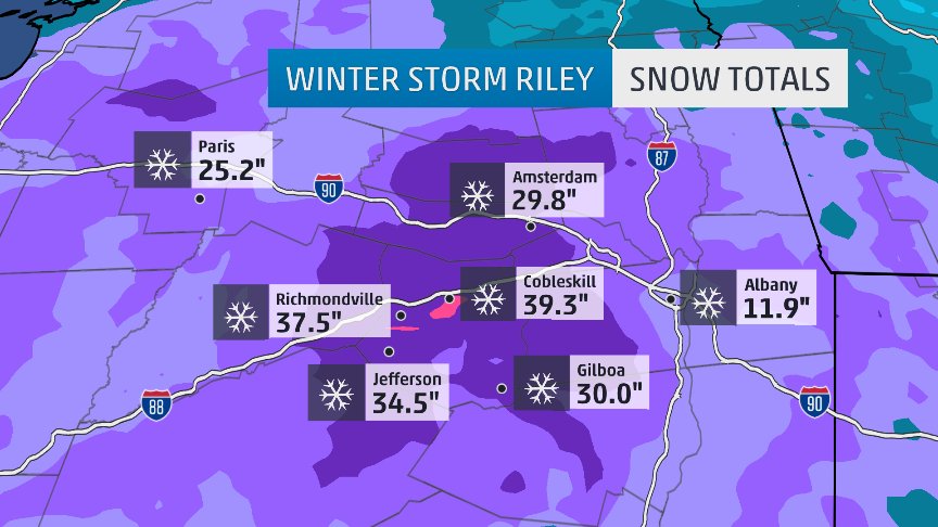
Ironically, a stronger storm can put down a lot more snow:
 Eric HolthausVerified account @EricHolthaus
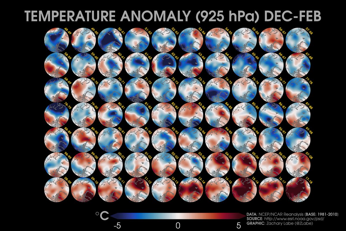
This year’s #Arctic winter (December through February) is a virtual tie (with 2015-16) for the warmest on record in at least the last 70 years…
[925 hPa air temperature; >67°N; R1 reanalysis]
