Monday July 16th… Dear Diary. The main purpose of this ongoing post will be to track United States extreme or record temperatures related to climate change. Any reports I see of ETs will be listed below the main topic of the day. I’ll refer to extreme or record temperatures as ETs (not extraterrestrials)😊. Here is today’s main climate change post related hot topic:
Another Historic Western Heatwave?
A couple of days ago I tweeted out this statement indicating that another eye popping heat dome or ridge was in the offing for the Southwest:

Extremely impressive heat dome will max out in the West next weekend leading to potential all-time records. Keep reading posts on http://guyonclimate.com for updates. @bhensonweather @EKMeteo @KHayhoe @1o5CleanEnergy @ClimateCentral @Weather_West @capitalweather
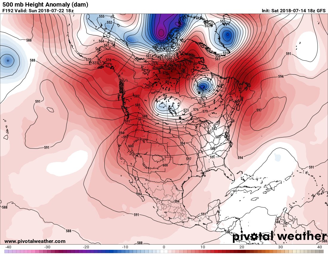

It remains to be seen if model temperature guidance will suggest that many all-time are in the offing in association with this heat dome. I’ll post some data from the 12Z model run later on this post that might give us clues. For now, here is the heat dome forecast at 18Z Sunday by the GFS, the same time frame as my initial tweet:

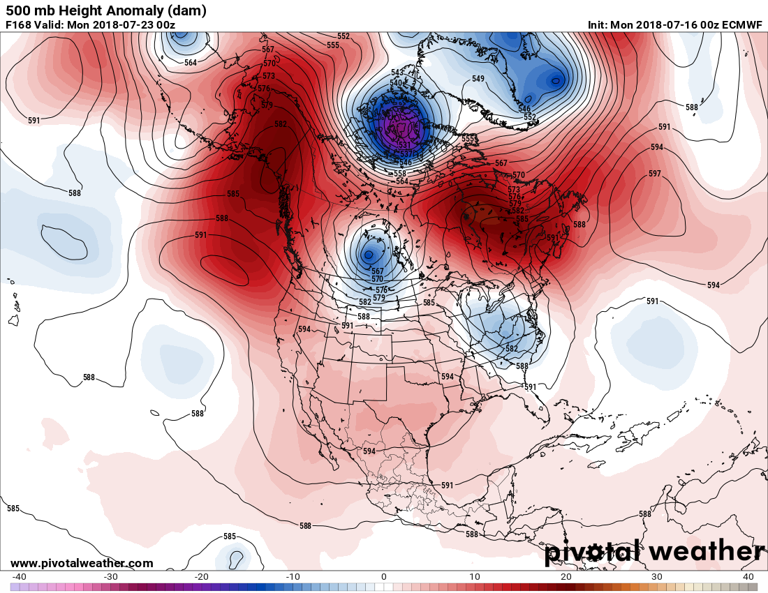
The trough/ridge configuration across the CONUS is about the same as that of the 18Z Saturday run, but 500 millibar heights are much lower.
Get ready for a prolonged heatwave, California! Once again, temperatures will rise above 105F across Los Angeles. While we will not see 117F like last week, but high may stay above 103F for a week or longer. pic.twitter.com/AaCEd9GQJg
— Edgar McGregor (@edgarrmcgregor) July 16, 2018
Will this heat wave eventually rival that of the Southern California heat wave? Keep reading my posts for updates.
…………………………………………………………………………………………..
Even before the start of any major heat wave tomorrow will be hotter across much of the Southwest into Texas:

A front will produce slightly cooler conditions for the Eastern Seaboard.
 Dr. Daniel SwainVerified account @Weather_West

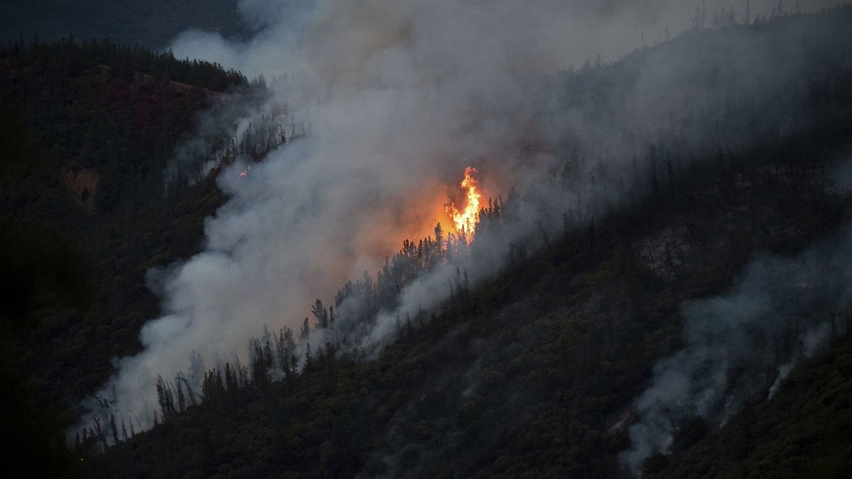
A deadly wildfire burning near Yosemite National Park grew to 9,266 acres overnight with only 2% of the blaze contained http://lat.ms/2NjUxkA
If you missed the @KALW discussion of California climate in context of recent heat extremes, here’s a link to recorded conversation with Noah Diffenbaugh (@StanfordEarth), Marty Hoerling (@NOAA_ESRL), and @Weather_West (@UCLAIoES/@nature_org): http://kalw.org/post/one-planet-heatwaves-and-climate-change?platform=hootsuite#stream/0 … #CAwx
 NASA GISSVerified account @NASAGISS
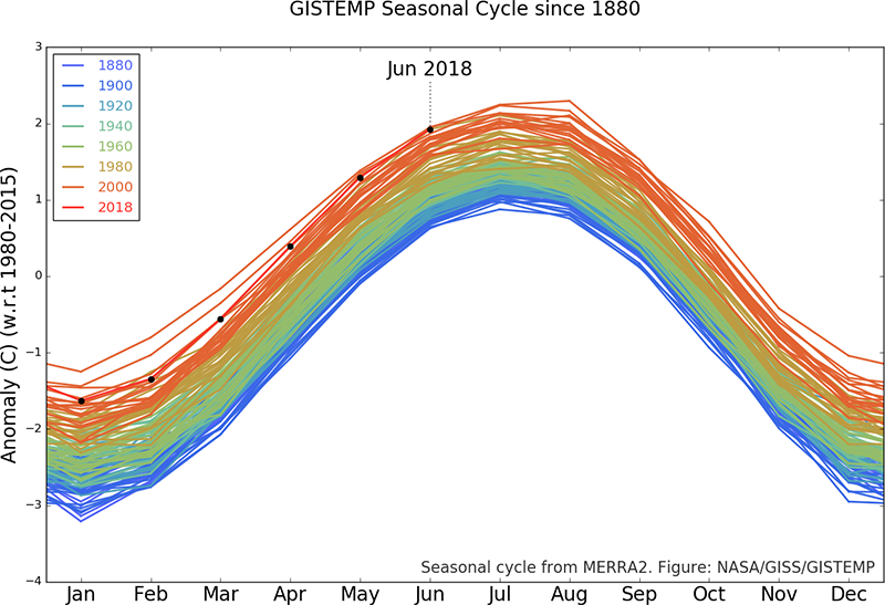
June 2018 was was tied for the third warmest June in 138 years of modern record-keeping at +0.77°C above the 1951-1980 baseline average. Only June 2015 and 2016 (+0.80°C and +0.79°C) were warmer. https://data.giss.nasa.gov/gistemp/news/20180716/ …

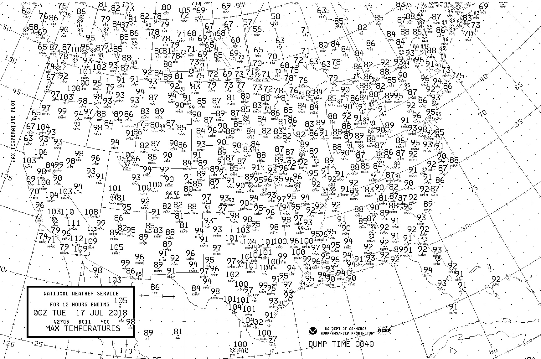
Maxes were slightly above average across most of the United States except in portions of the southern Rockies due to monsoon moisture.
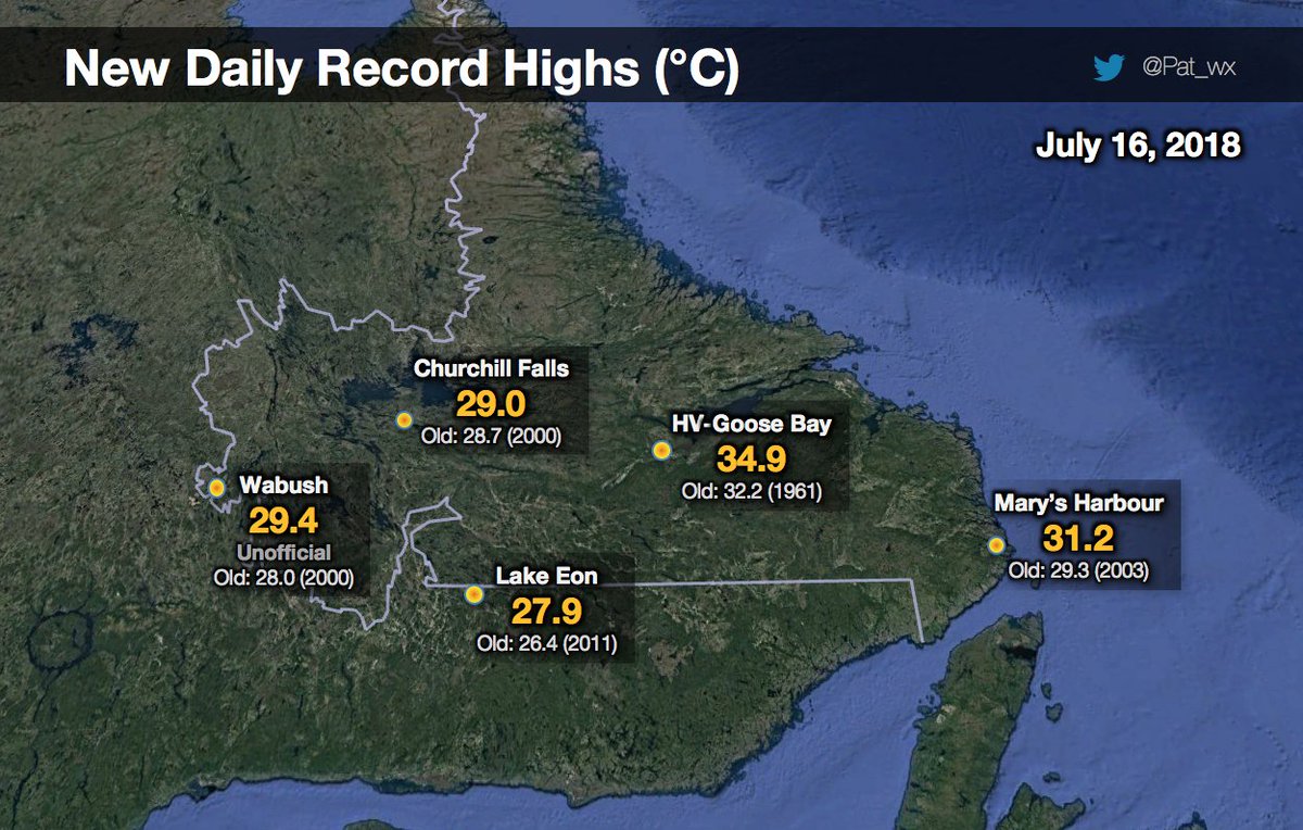
It’s still warm in Canada:

(If you like these posts and my work please contribute via the PayPal widget, which has recently been added to this site. Thanks in advance for any support.)
The Climate Guy