Thursday July 2nd… Dear Diary. The main purpose of this ongoing blog will be to track United States extreme or record temperatures related to climate change. Any reports I see of ETs will be listed below the main topic of the day. I’ll refer to extreme or record temperatures as ETs (not extraterrestrials).😉
Main Topic: Introducing A Saffir-Simpson Type Scale For Heat Waves
Dear Diary. We as humans are geared towards compartmentalizing via scales and measures, also becoming focused on items and events if they are named, such as hurricanes. Certainly the media is. That’s why the Saffir-Simpson Scale for hurricanes and Fujita Scale for tornadoes came into being in the world of weather. The Weather Channel over the last few years has taken up the practice of naming winter storms to garner attention. In this day and age of increased global warming would it not make sense to clarify the severity of heat waves via a scale with numbers?
Today let’s initially try to define heat wave severity and intensity on a day to day basis. My parameters introduced today are fairly rough around the edges and somewhat subjective, but if there is enough discussion and consensus within the meteorological community perhaps in time harder definitions based on sound science can come to fruition.
Mirroring the Saffir-Simpson scale let’s define a weak or low level category one heat wave as a fairly minor nuisance that can be dealt with using proper precautions and one that is truly deadly, in which you would not want to leave a location with air conditioning to go outside under any circumstances for no more than a few minutes, as a five. What I will do here is roughly define this 1-5 scale and give an example, also using 500 millibar charts.
1) CAT 1: Low level heat wave. Occurs when temperatures and humidity get hot enough to threaten the health of susceptible people over an area at least as large as a mid American state. Heat advisories from the National Weather Service will be in place with perhaps a small area of heat warnings. Temperatures don’t necessarily have to get as hot as record levels, but humidity levels must be sufficient to produce a heat index above 95F.
The typical early July weather we see today across the south-central U.S. is spot on for a CAT 1 heat wave. Here are current heat advisories posted for Thursday:
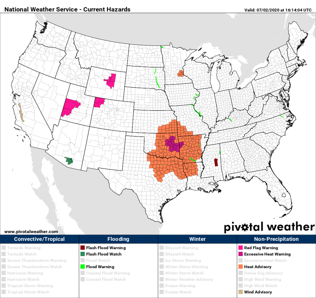
For the rest of this summer (or as long as heat advisories are posted for a portion of the United States) I will post this NWS graphic describing the severity of our ongoing heat wave on a scale of 1-5 before I get into the main topic of the day.
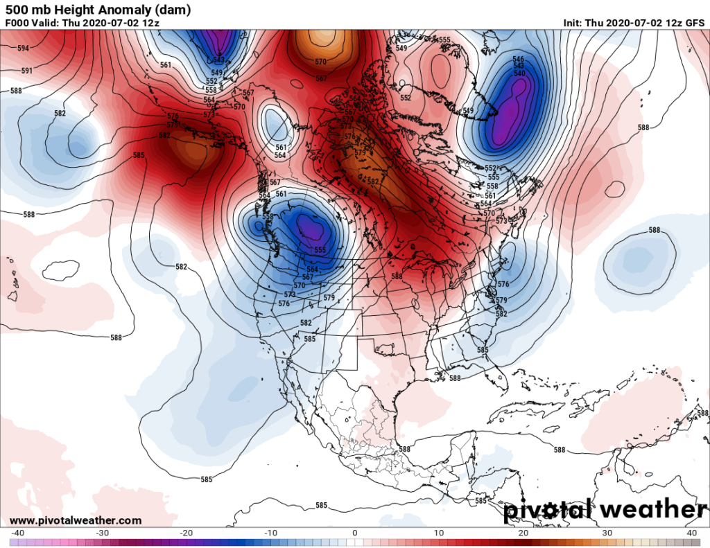
At 500 millibars here is what we see from this morning, which would be typical for my CAT 1 heat wave definition:
2) CAT 2: Medium level heat wave in which areas have been subjected to temperatures and humidity sufficient to produce NWS heat advisories and warnings for at least three consecutive days over a widening area about the size of Texas. Temperatures may get close to record levels for a couple of days.
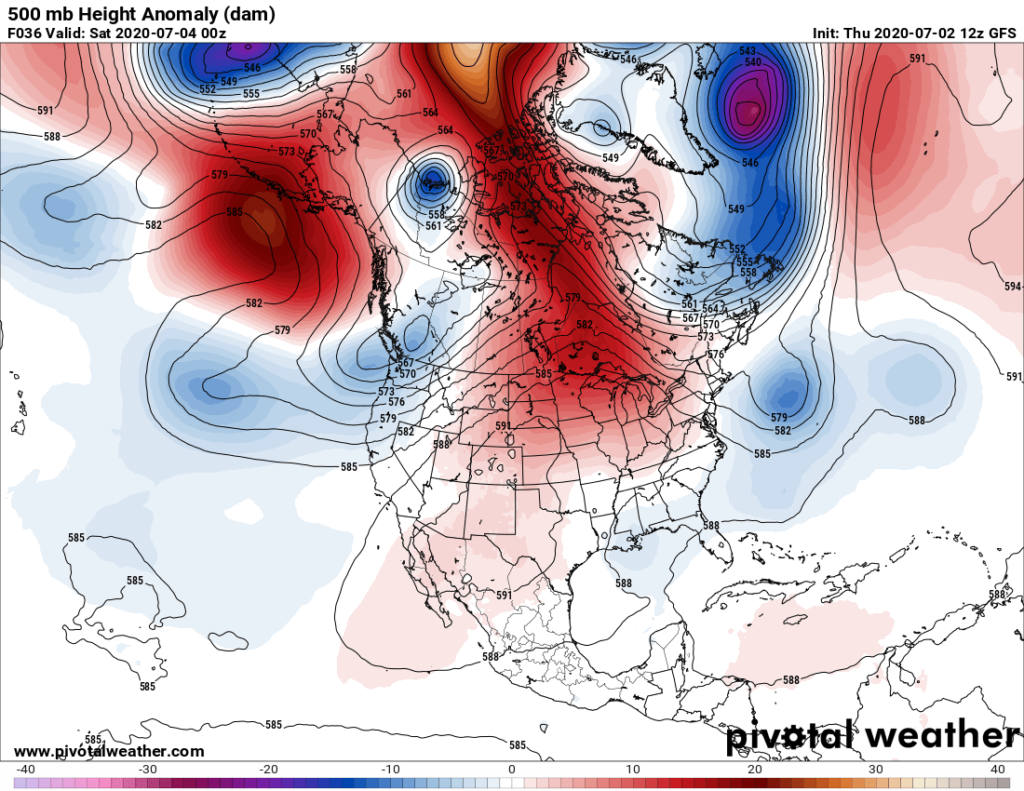
My meteorological tea leaves are telling me that our current CAT 1 heat wave will become a CAT 2 over the 4th of July holiday weekend:
3) CAT 3: Medium level heat wave severe enough such that a few fatalities are reported. A city in a CAT 3 heat wave would be under a heat emergency for a few days. Many heat records would be either tied or broken with the heat wave encompassing at least one quarter of the nation, but probably with a short term end in sight.
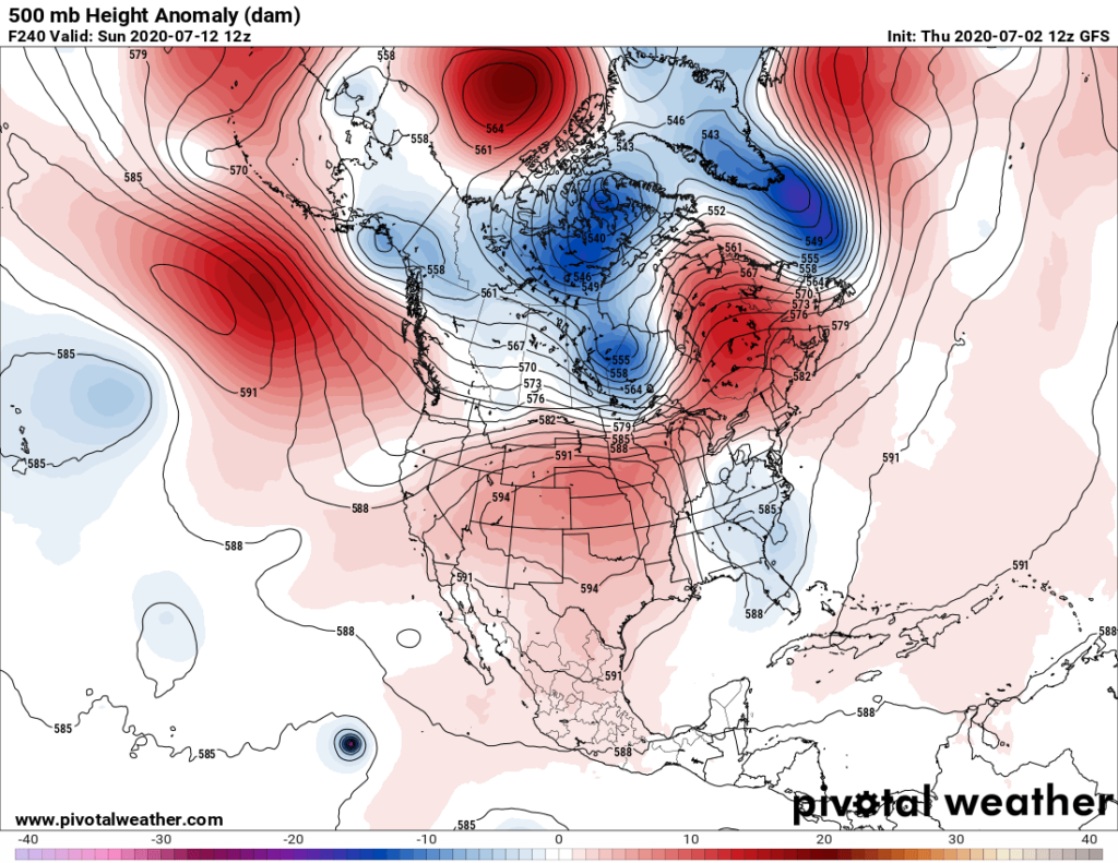
Indeed our CAT 1 or 2 heat wave could be developing into a CAT 3 system if we see a 500 millibar ridge enveloping much of the Plains for several consecutive days later this month:
4) CAT 4: High level heat wave severe enough to produce over 500 deaths. The city of Chicago had one of these back in 1995. Read about that here:
https://en.wikipedia.org/wiki/1995_Chicago_heat_wave
Our models in the “fantasy land” range beyond 240 hours out forecast a ridge at 500 millibars that could kill over 500 susceptible people, but would probably have to be centered over the Upper Midwest to do so.
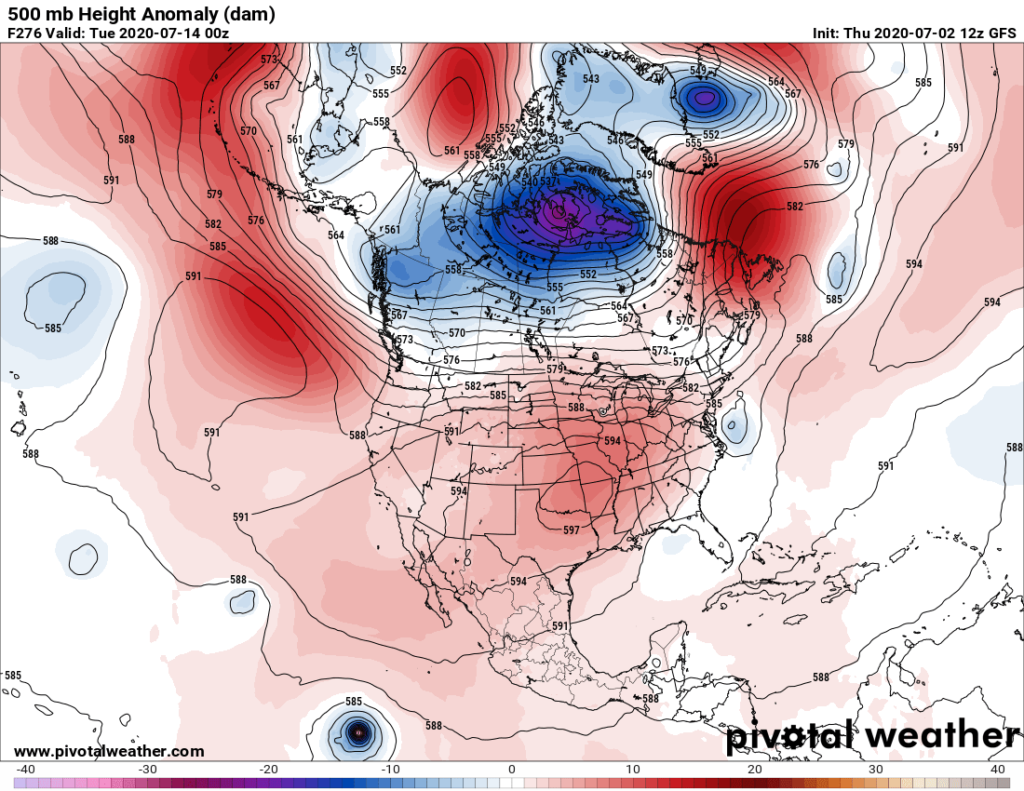
5) CAT 5. Catastrophic heat wave. Many all-time temperature records would be shattered with thousands if deaths a possibility. Remember the European heat wave of 2003 in which there were well in excess of 10,000 fatalities? This event would certainly fit my CAT 5 category.
https://en.wikipedia.org/wiki/2003_European_heat_wave
| Difference in average temperature (2000, 2001, 2002 and 2012) from 2003, covering the date range of 20 July – 20 August[1] | |
| Date | July 2003 – August 2003 |
|---|---|
| Location | Europe |
| Type | Heat wave |
| Deaths | 50,000 – 70,000 |

I welcome any constructive critiques for this heat wave scale. Also, before anybody gets the idea of naming these heat events, much like we now do for hurricanes or winter storms, we need to see more refined criteria. Am looking forward to any reader comments.
Speaking of the current or coming July heat:
Here is one big “ET” reported from Alaska on Thursday.
Here is more climate and weather news from Thursday:
(As usual, this will be a fluid post in which more information gets added during the day as it crosses my radar, crediting all who have put it on-line. Items will be archived on this site for posterity. In most instances click on the pictures of each tweet to see each article. The most noteworthy items will be listed first.)
Now here are some of today’s articles and notes on the horrid COVID-19 pandemic:
(If you like these posts and my work please contribute via the PayPal widget, which has recently been added to this site. Thanks in advance for any support.)
Guy Walton “The Climate Guy”
One thought on “Extreme Temperature Diary- Thursday July 2nd, 2020/ Main Topic: Introducing A Saffir-Simpson Type Scale For Heat Waves”