The main purpose of this ongoing blog will be to track planetary extreme or record temperatures related to climate change. Any reports I see of ETs will be listed below the main topic of the day. I’ll refer to extreme or record temperatures as ETs (not extraterrestrials).😉
Main Topic: Watching Heat Wave Epsilon Day Five…Dangerous Conditions Intensify Across The Plains And South
Dear Diary. It now appears that through Friday Heat Wave Epsilon will be expanding across the Plains and South. While dangerous heat and humidity conditions will be intensifying, it does not look like there will be many all-tine or even monthly records produced by Epsilon. We’ll see, though, if Epsilon gets up to a CAT 4 ranking, which would require at least some monthly and all-time records to achieve that ranking.
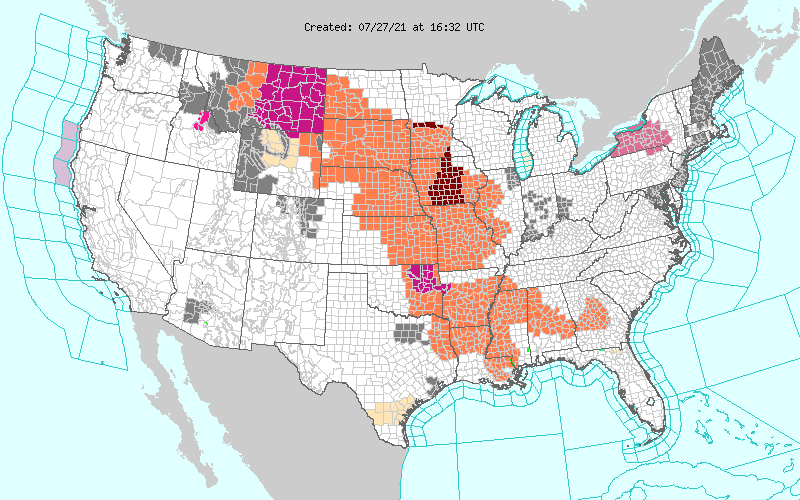
This morning we have a very large area of gear advisories that gave expanded overnight from the Pacific Northwest through the Plains into the South and Southeast:
Fortunately, the heat dome in association with Epsilon will max out on Thursday at barely 597 or 598 decameters, probably over Kansas:
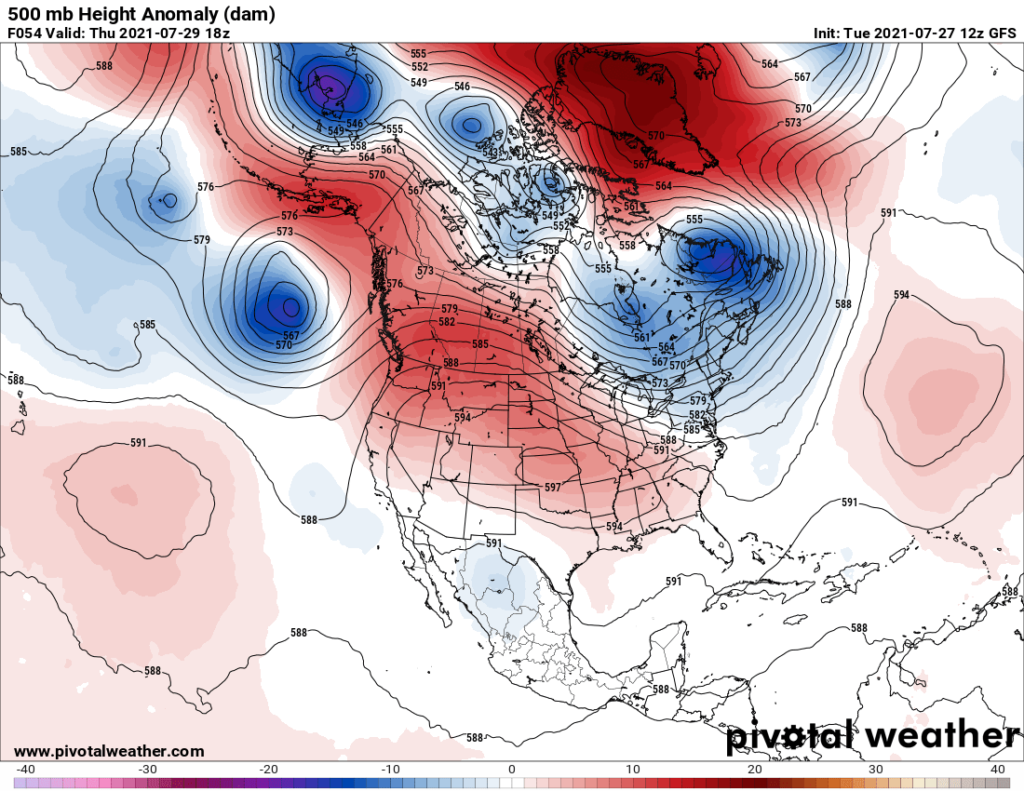
During my near 40 year career as a meteorologist I’ve seen much worse in the Plains and West but never any heat dome above 602 decameters. Also, I’ve witnessed ridges during United States heatwaves that have lasted far longer than Epsilon will. Thankfully, most prior models from last week going past five days were wrong prolonging the ridge into August, and a trough should develop by this weekend, greatly curtailing Epsilon, if not ending this heat episode all together.
P.S. Some Twitter participants have asked me about measurements and nomenclature in association with heat domes are meteorological ridges. Here is a brief tutorial I wrote four years ago that I hope will be helpful to understand these blogs:
Nevertheless, Epsilon will produce conditions that should not be taken lightly. Here are model forecast maxes for today and Tuesday:
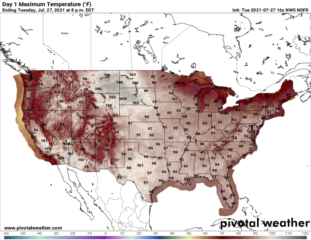
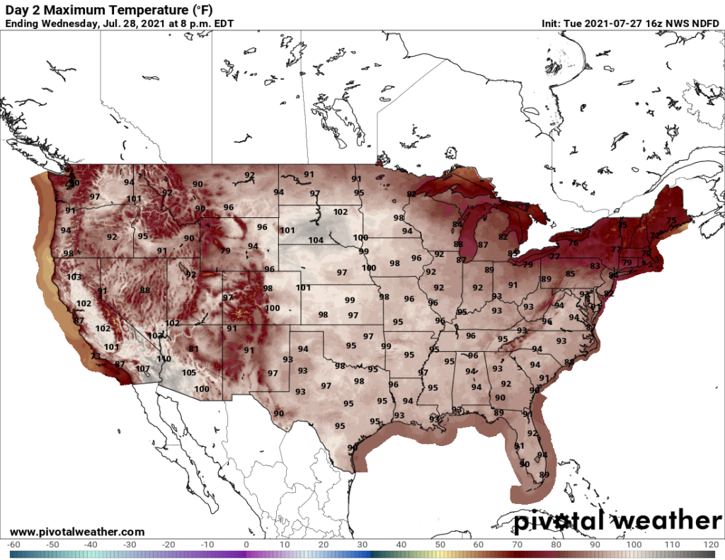
By looking at these numbers it’s obvious that the worst conditions will be in Montana and the northern Plains through Tuesday. We’ll be watching for “ET’s” to be flying out of that area during the middle part of this week.
Further notes on Epsilon:
Here are some “ET’s” reported on Tuesday:
Here is today’s featured climate crisis related item:
Here is more climate and weather news from Tuesday:
(As usual, this will be a fluid post in which more information gets added during the day as it crosses my radar, crediting all who have put it on-line. Items will be archived on this site for posterity. In most instances click on the pictures of each tweet to see each article. The most noteworthy items will be listed first.)
Now here are some of today’s articles and notes on the horrid COVID-19 pandemic:
(If you like these posts and my work please contribute via the PayPal widget, which has recently been added to this site. Thanks in advance for any support.)
Guy Walton “The Climate Guy”