The main purpose of this ongoing blog will be to track planetary extreme, or record temperatures related to climate change. Any reports I see of ETs will be listed below the main topic of the day. I’ll refer to extreme or record temperatures as ETs (not extraterrestrials).😜
Main Topic: Day 4 (An American Tragedy)-CAT3/4 Hurricane Milton Headed Towards Tampa and Orlando
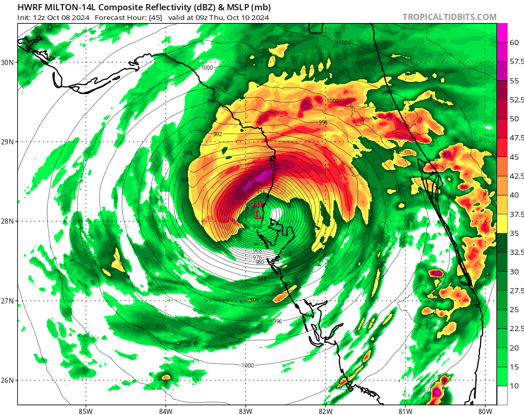
Dear Diary. The proverbial writing is on the wall. Milton will arrive in the Tampa area Wednesday Night probably as a high end major CAT3 according to the National Hurricane Center. The only question is how far north its eye will get in relation to the bay. The worst-case scenario would be if Milton’s passed just north of Tampa Bay, which would maximize storm damage.
It’s also now a given that Milton will race through the I-4 corridor Thursday morning and devastate Orlando, the home of Disney World. As stated yesterday:
As we have posted the last three days that we have been concentrating on Milton, here is some of the latest guidance:
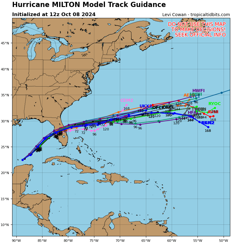

As one can see, guidance has come together for a near Tampa landfall if you glance back at yesterday’s diary post, but Milton may come in as far south as Sarasota looking at afternoon trends.
Here are a few notes from the head meteorologist at the Washington Post:
Meteorologists are extremely alarmed about Milton. What they’re saying.

The prospect of a major hurricane, rated Category 3 or higher, making a direct strike on flood-prone Tampa is eliciting strong, candid statements from meteorologists, concerned about the danger and the cost.
Here are some of the things they’re saying:
- “Milton bears all the hallmarks of the most impactful and consequential hurricanes in American history. Catastrophic storm surge will rival century-old records along Florida’s west coast, with major inland flooding an increasing concern.” — Michael Lowry, hurricane specialist for Miami television affiliate WPLG.
- “It is very likely that Milton will be a highly destructive hurricane costing over $10 billion for Florida — and Milton could end up placing among the costliest U.S. hurricanes on record, depending on the eventual details of landfall. The risk is also high that Milton will be very deadly if people in low-lying areas do not heed evacuation orders and flee the hurricane.” — Jeff Masters and Bob Henson, meteorologists for Yale Climate Connection.
- “[The surge] will move homes, it will move cars. It is going to be catastrophic. Those words I can be very confident in,” — Ginger Zee, chief meteorologist for ABC News.
- “No mincing words here. People who live along the coast and do not evacuate are risking their lives,” — Denis Phillips, chief meteorologist for Tampa’s ABC affiliate.
- “Extremely life-threatening storm surge along the West Florida coast, destructive and life-threatening winds along the coast and spreading across inland locations, and areas of heavy rainfall resulting in flash flooding are all possible. … It cannot be stressed enough to please follow the guidance of local emergency management and evacuate if told to do so,” — Forecasters at the National Weather Service office in Tampa Bay.
Much More (Newest and most important items will be listed first. I’ll have many updates as Tuesday rolls along):
Here are more “ETs” recorded from around the planet the last couple of days, their consequences, and some extreme temperature outlooks, as well as any extreme precipitation reports:
Here is some more September 2024 climatology (Prior reports are listed on older daily diary blogs for each calendar day.):
Here is More Climate News from Tuesday:
(As usual, this will be a fluid post in which more information gets added during the day as it crosses my radar, crediting all who have put it on-line. Items will be archived on this site for posterity. In most instances click on the pictures of each tweet to see each article. The most noteworthy items will be listed first.)