Thursday March 1st… Dear Diary. The main purpose of this ongoing post will be to track United States extreme or record temperatures related to climate change. Any reports I see of ETs will be listed below the main topic of the day. I’ll refer to extreme temperatures as ETs (not extraterrestrials)😊. Here is today’s main climate change related topic: End of the “False” Spring
Today marks the end of what is termed meteorological or boreal winter and the beginning of spring, although officially spring won’t begin until the Vernal Equinox on March 20th this year. Already though spring like, even summer like, weather has occurred up and down the East Coast in February causing flora to bud and bloom early. Now the meteorological tea leaves are telling me that true winter is making a return, which could stunt any early bloomers.
So what is a “false spring” in relation to climate change? I first dealt with this subject here:
https://guyonclimate.com/2018/02/18/extreme-temperature-diary-february-18-2018-the-false-spring/
Basically a false spring is when warmth or heat of record proportion occurs in winter such that sprouts or blooms grow early putting vegetation in jeopardy for damage due to a later freeze. These false springs are occurring more frequently due to the beginnings of climate change. One such occurrence happened in February when an unprecedented 594+ decameter 500 millibar ridge built off the mid-Atlantic Coast. Now the other shoe is in the process of dropping with a big flip in the weather pattern.
A chilly nor’easter has already replaced the February Northeast warmth. Please read more about this system that actually does have a few climate change facets due to rising waters here: https://www.wunderground.com/cat6/major-coastal-flooding-expected-fridays-noreaster. The most powerful winter storm to hit the West during their mild winter season will move into the East by next Wednesday or Thursday ushering in freezing temperatures to the South, which would be fairly typical for early March by climate standards set over the last century. Thank goodness this nippiness won’t be occurring later in the spring when much more vegetation would be blooming.
So why would a chilly nor’easter and a late winter storm digging into the South have climate change connections? The answer, both are being affected by the Arctic warmth over the last week which is linked to the polar vortex. A huge, warm blocking ridge (as noted by the red on the Penn State ensemble chart and is the positive phase of the North Atlantic Oscillation) will prevent the nor’easter from moving out to sea very fast and probably will affect the strength and intensity of the thing. The same warm ridge usually leads to its counterpart, a deepening cold trough in the East, which will produce a lot of snow in the Midwest from the storm moving out of the West and usher in cold air across the South:

Also:


Here are some chilly two meter temperatures valid for next Friday morning via the GFS model:
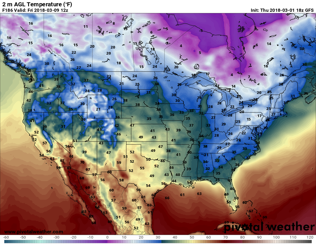
Surface temps might be a tad cooler across the Southeast. All in all, what I’ve seen over the last couple of decades as a meteorologist leads me to believe that there will be more wild fluctuations in temperatures with false springs in winter and anomalously cold weather in early spring due to early climate change. I’ll let all know how trends go in the next week.
The Climate Guy