Friday October 5th… Dear Diary. The main purpose of this ongoing post will be to track United States extreme or record temperatures related to climate change. Any reports I see of ETs will be listed below the main topic of the day. I’ll refer to extreme or record temperatures as ETs (not extraterrestrials)😊. Here is today’s main climate change related topic:
All Talk And No Walk From Kyoto To Paris…An Editorial
What has me fuming today is seeing many an article this week stating that it will take “a great effort” to keep global averages below +1.5C or +2.0C above preindustrial conditions. Ever since 1992 I have witnessed countless global “agreements” to limit CO2 pollution from Kyoto to Copenhagen to Paris in 2015 without many results. True, beginning this decade there have been great strides in green technology and infrastructure, but the planet keeps getting more hungry for energy negating most progress to reign in higher CO2 levels. Just take a gander at this site to see: https://www.co2.earth/
I keep seeing messages and dire warning such as this:
Over the last 150 years, humanity has emitted enough greenhouse gases into Earth’s atmosphere to bring carbon dioxide levels up to the highest they’ve been in 800,000 years. The planet is already warmer than it’s been in 120,000 years.
https://mashable.com/article/colorado-river-drought-global-warming/#x3OL4bNtDZqz
10:02 PM – 4 Oct 2018
From October 2017 to October 2018 CO2 levels went from 402.96 ppm to 405.44 ppm, a net gain of 2.48 parts per million. From year to year since the turn of the century I am seeing about a 2.5 parts per million annual rise in CO2 levels in the atmosphere with very little deviation of the upward trend. Are we all fooling ourselves that any “weak”global treaties will make much of a difference?
In my life what I can’t stand from another soul is when they say they will commit to something and then not follow through. Starting with the Kyoto agreement for nearly thirty subsequent years I have heard promises that indeed emissions will be curtailed, and that individual countries will fall in line, policing industry such that concentrations of CO2 will level off and perhaps even fall. Beware of empty promises, especially when it comes to the world’s climate. Let’s see if this example of commitments is really serious and pans out:
Limiting global warming to 1.5 °C above pre industrial temp means emissions must fall to #NetZero ASAP


Here are Friday’s Maxes:
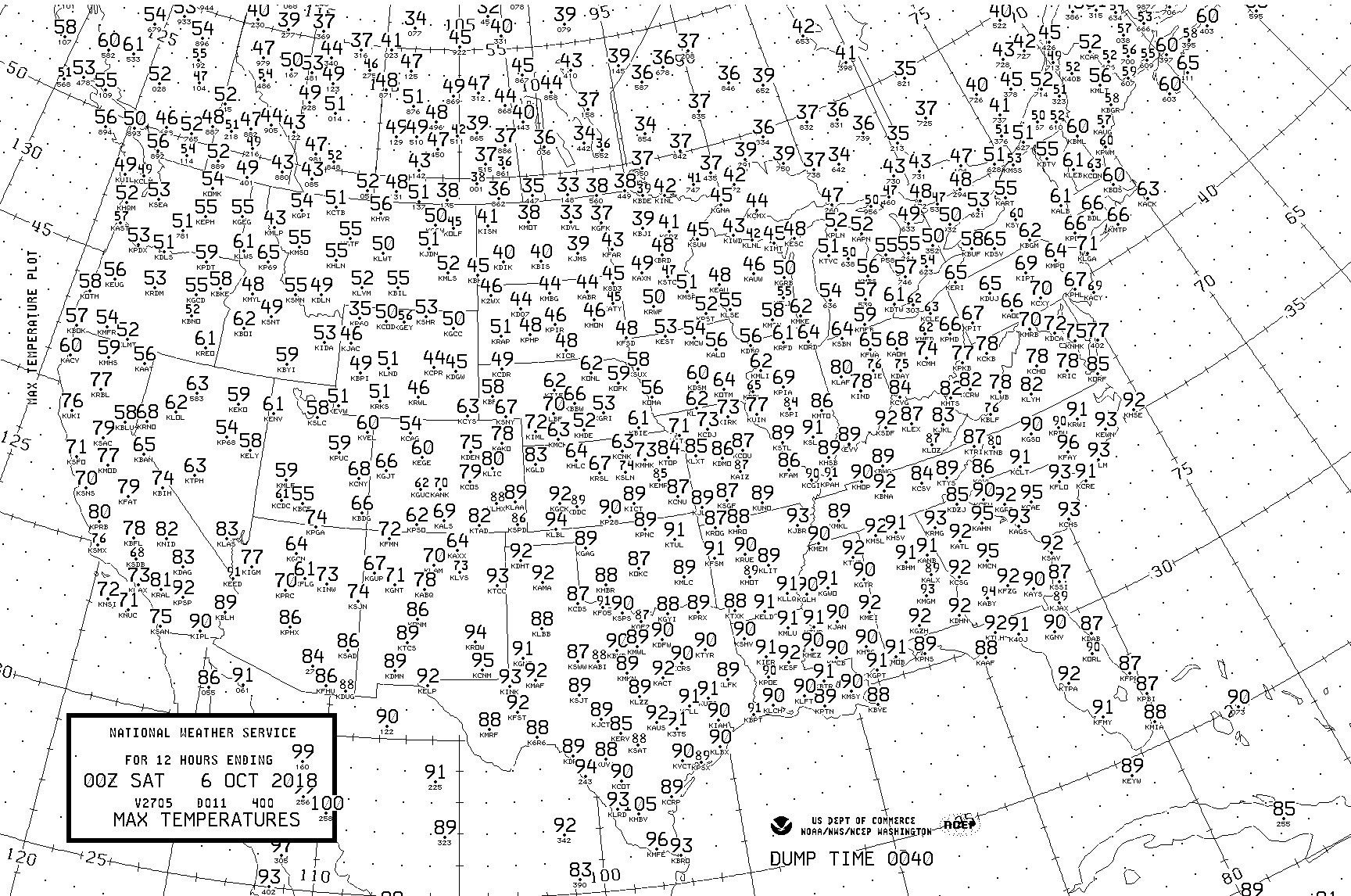
Maxes were very close to daily records across the South. Fall is here to stay from the Northwest eastward through the Upper Midwest.
(As usual, this will be a fluid post in which more information gets added during the day as it crosses my radar, crediting all who have put it on-line. Items will be archived on this site for posterity.)
I’m getting more concerned that near record warmth across the South and East will lead to at least a tropical depression or storm moving into the Gulf of Mexico next week:
Odds are rising that a tropical cyclone will move across the Gulf of Mexico toward the central Gulf Coast next week https://bit.ly/2PlFA2M
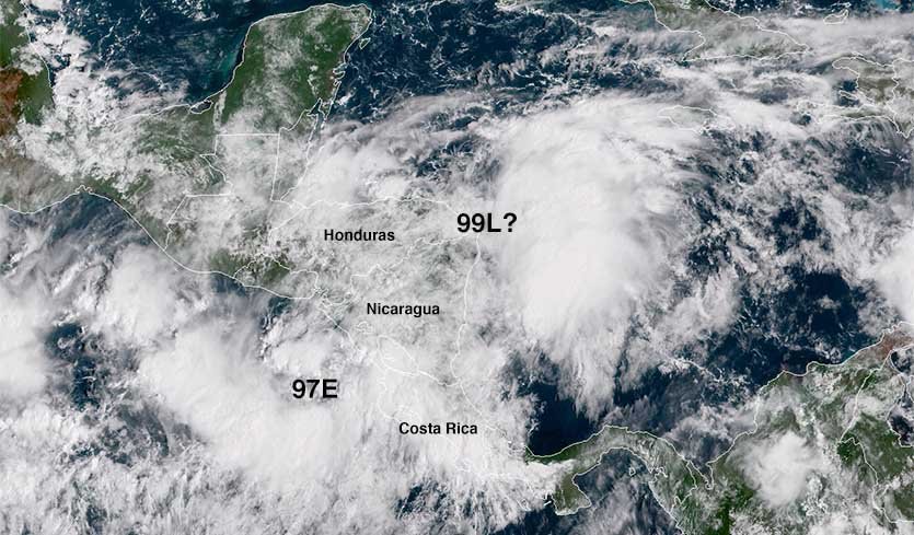
Am now greatly concerned that by early next week a tropical system will be moving into the Gulf. Yep, my 30+ years of experience are paying off, so all of my Twitter followers were informed first. Thanks for your support! @scook2214 @MichaelEMann @TheBradBlog @BernadetteWoods
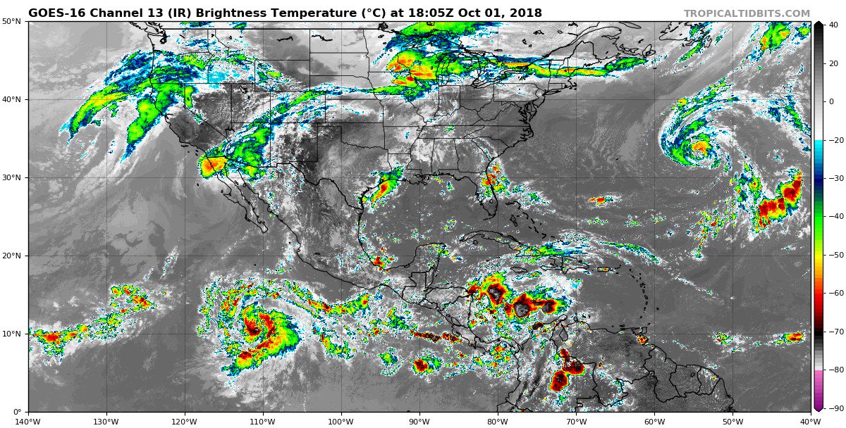
Models are starting to sniff out a potential developing tropical cyclone over the Gulf of Mexico next week. If a storm develops, there’s a high chance it would impact somewhere along the Gulf States. Follow the @NHC_Atlantic for daily updates on this potential storm.
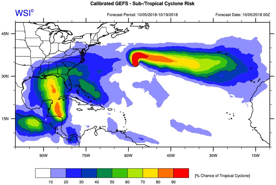
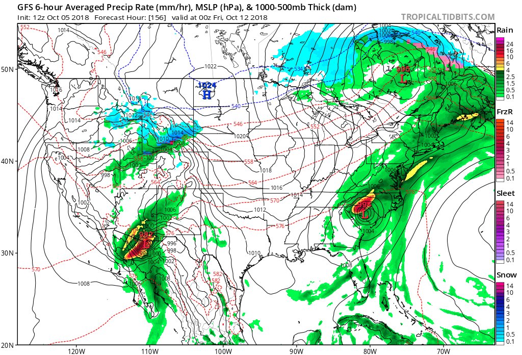
FV3-GFS model 10 day forecast W. Atlantic 10/5 12 pm
A T.D. forms SE of the Yucatan, becomes a T.S and moves North over the Gulf making landfall on Mississippi coast as a strong T.S.. It then moves NE over the SE U.S. as a subtropical storm and dissipates. pic.twitter.com/D6HFSwfOOa— Scott Cook (@scook2214) October 5, 2018
The #Hurricane #Sergio forecast is most interesting for what its remnants may do late next week. https://wxch.nl/2NqlbI4
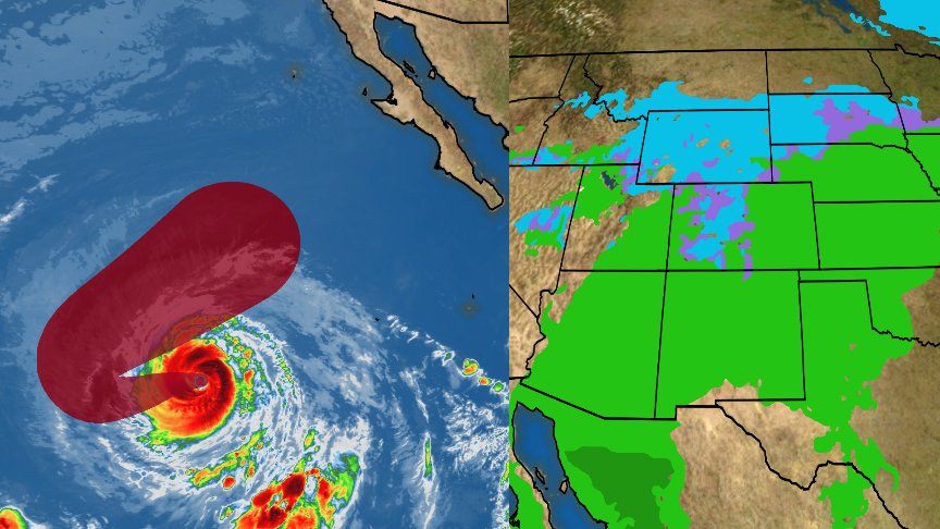
Possible double tropical trouble. #Sergio hits the Soutwest while what forms in the Gulf moves through the Southeast next week.
Here is some of today’s other weather and climate news:
Florida’s Expanding Red Tide Rides Rising Ocean Waters: http://youtu.be/nBzeIteiqJI?a via @YouTube
1:12 PM – 5 Oct 2018
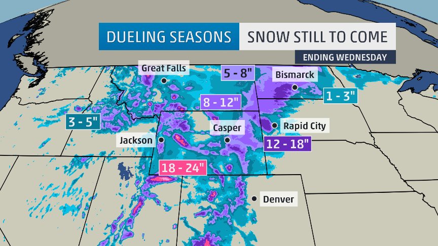
We ought to be seeing more fall color by now, but many of us are still waiting for autumn to appear. Who’s going to see summer continue and who else is getting a taste of winter? Some answers:
1:45 PM – 4 Oct 2018
Still lots of model uncertainty, but looking more likely for extended period of #snow for #Rockies and parts of #NorthernPlains late weekend into next week. Here’s latest Weather Channel total snowfall forecast. #winteriscoming
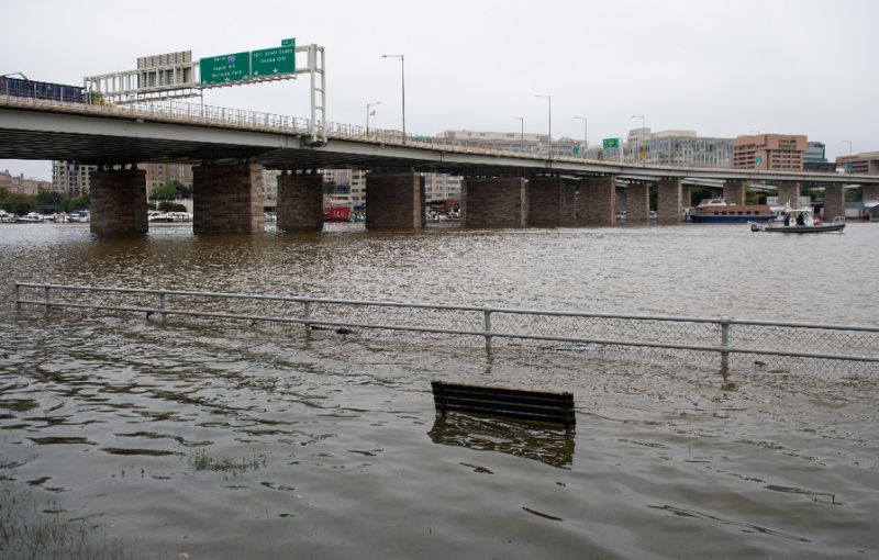
From the office. With NOAA data, we looked at the frequency of coastal flooding during king tide season at 30 U.S. sites – past and present. And the frequency of future flooding just from regular tidal cycles and sea level rise. See all 30 sites at: http://www.climatecentral.org/outreach/alert-archive/2018/2018KingTides-English-Dropdown-WEB.html …

#Nome high temperature thru 2pm AKDT Friday is 50F (10C), making this the fifth day this month with a high of 50F or higher. In 110 years of climate obs, Nome has never had an October with this many days so warm. #akwx #Arctic @KNOMnews @lisashefguy @mdiaak54 @Climatologist49
Why is climate changing faster than feared?
Conservative models “failed to capture the full impacts of a warming planet on extreme weather events such as those that broke out across North America, Europe and Asia this summer,” @MichaelEMann tells @AFP http://ow.ly/Tlx430m7b43
(If you like these posts and my work please contribute via the PayPal widget, which has recently been added to this site. Thanks in advance for any support.)
The Climate Guy


