Wednesday September 12th… Dear Diary. The main purpose of this ongoing post will be to track United States extreme or record temperatures related to climate change. Any reports I see of ETs will be listed below the main topic of the day. I’ll refer to extreme or record temperatures as ETs (not extraterrestrials)😊. Here is today’s main climate change related topic:
Tracking Florence Day Four
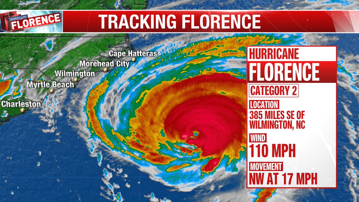
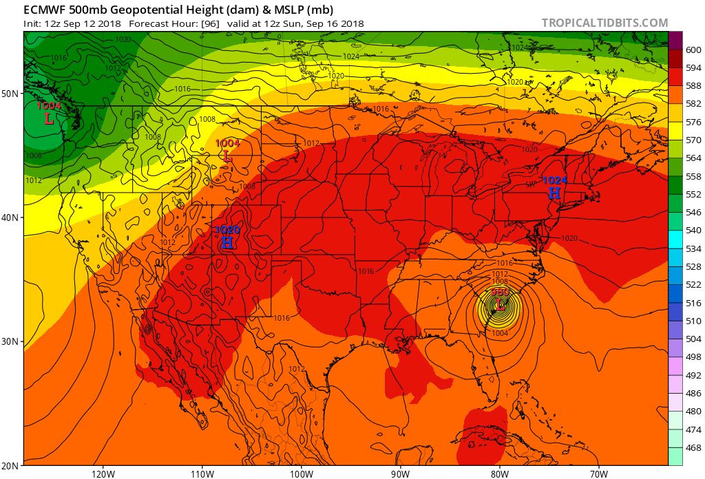
From Tuesday afternoon through the overnight hours we had quite the model shift with just about all guidance stalling Florence around the southern North Carolina coast as a CAT 3/4, then moving the system southwest towards Charleston weakening the thing, thankfully, along the track. I’d like all reading to think how unusual a scenario this would be for mid September if it verified. The upper ridge north and west of Florence resembles one typically seen from July into August, not now. Hurricanes moving towards the U.S. in Florence’s current position usually recurve away from the U.S. in September because of early fall systems moving through America. If any organized tropical system manages to make it towards the Carolinas cooler sea surface temperatures north of the deep tropics prevent a major hurricane from making landfall. This season’s SSTs are extra warm. All of these factors point to Florence being influenced by anthropogenic global warming.
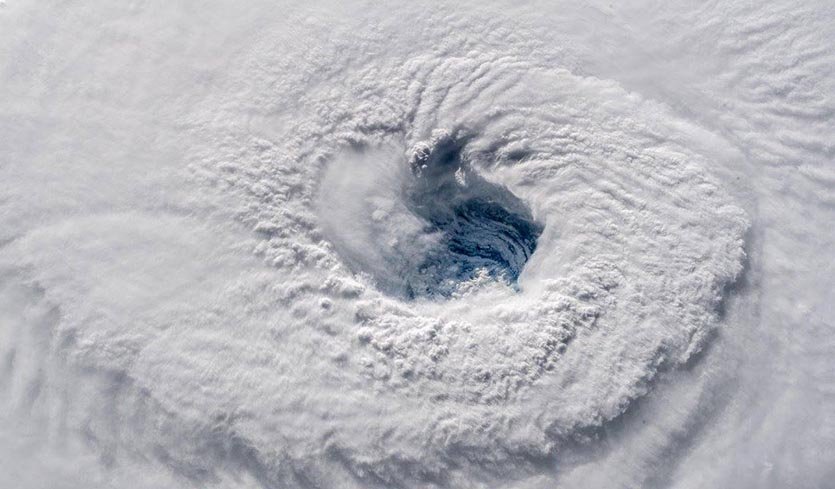
Some good news occurred overnight. Yet another eyewall replacement cycle prevented Florence from becoming a monster CAT 5 hurricane. The bad news is that the cycle expanded or enlarged Florence’s core of deadly winds. Florence will probably fluctuate in strength through today, but with luck some light wind shear will weaken the system before a close encounter with land late Thursday into Friday. I would not be surprised at all if Florence’s official landfall came in at CAT 2 strength if the system doddles off the Southeast Coast for days, but this is not officially forecast. Too, if Florence does not totally move inland the lashing of a huge area may be worse than if a CAT 4 hurricane quickly moved inland as was the case with Hugo in 1989.
Here are some of today’s messages, which will be kept for posterity, in association with Florence. As I have been writing, I’m not going to second guess the National Hurricane Center, the best and most trusted source, unless guidance greatly deviates from their forecast. Usually if models go in a different direction NHC will make adjustments. I will snapshot model scenarios, but all reading this post should follow NHC as presented by The Weather Channel to get the best forecast. I will group information in this fluid post under each six hour period in which model guidance is processed. The latest guidance will be at the beginning of the article with archived prior messages kept towards the end of Wednesday’s Diary. I’ll label each group with the time models are processed. So here we go:
Information coming in after the 00Z Thursday models from 9/13/2018 were processed:
The latest iteration of our IMR group's work. This is what storm surge looks like. #Florence will make landfall in the next 36-48 hours and bring with it, 6-9 feet of potential storm surge. @parkertwc will show you what that looks like. @LocalNow @weatherchannel #NCwx #SCwx pic.twitter.com/mG9JjOOJeM
— Ryan Davidson (@RyanDavidsonWX) September 13, 2018
The “stubborn” operational EURO at 00Z THU continues to insist that #Florence will take a more southwestern than what NHC forecasts ending up near Charleston before moving inland by Sunday. System floods Southeast then ends up in the Northeast. Not a good scenario at all.
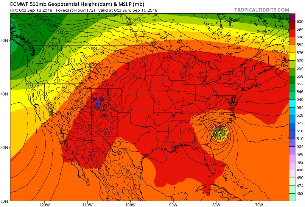
Let's talk about #Hurricane #Florence stalling over NC/SC over the next few days. I've made an .mp4 video.
Key pieces:
1) Ridges amplify N & W of TC, blocking motion as TC reaches coast.
2) Trough rounding the ridge digs in behind, allowing TC to begin a westward motion inland. pic.twitter.com/Jr4uPITLtA— Philippe Papin (@pppapin) September 13, 2018
Uh oh. That shear has weakened:
Disturbing trend on satellite images tonight. #Florence seems to be flaring as it hits warmer water and less wind shear. A more concentric convection core is forming around the center. This storm may still strengthen overnight and as it approaches the coast Thursday. #ncwx #scwx pic.twitter.com/0DyC18ifKt
— MPR Weather (@MPRweather) September 13, 2018
Hurricane Florence Experimental FV3-GFS 10 day forecast 12 am EST. A strong high pressure ridge coming off the N East coast dips down behind Florence from a low pressure trough in the E Central Atlantic & steers Florence NW and then NNW, strengthening with a landfall of a👇👇 pic.twitter.com/QuIQS0WOPR
— Scott Cook (@scook2214) September 13, 2018
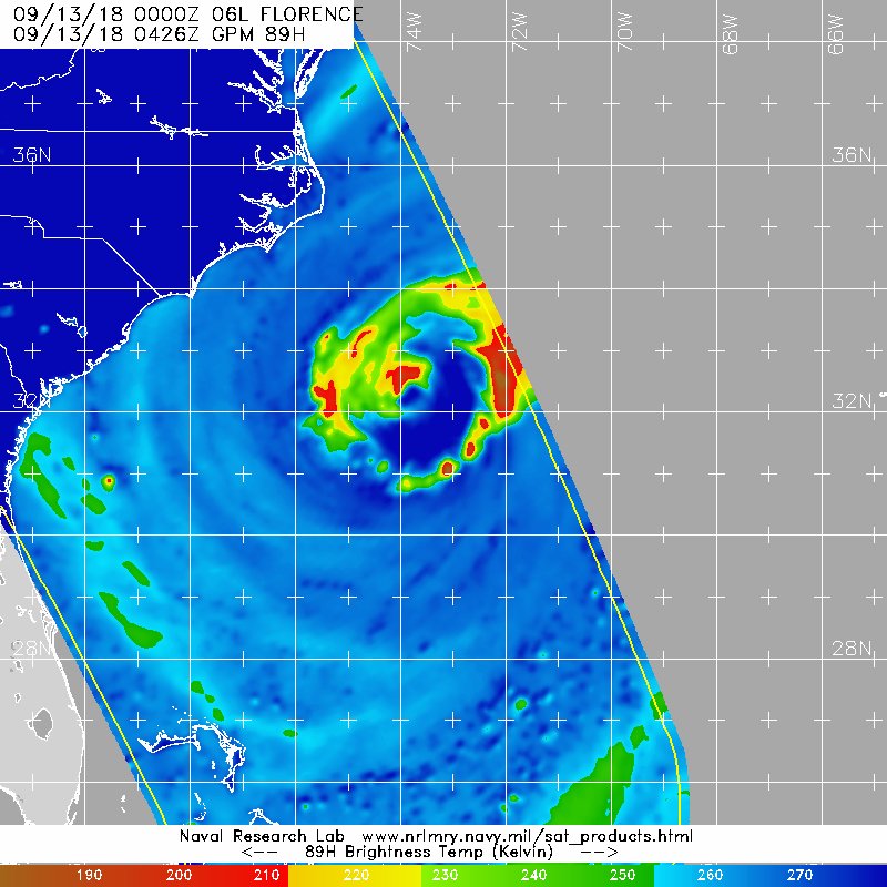
Latest pass of microwave imagery over #Florence shows an inner core / inner eyewall that is perhaps not as impressive as IR satellite may suggest. But in fact a more together (and huge) outer eyewall.
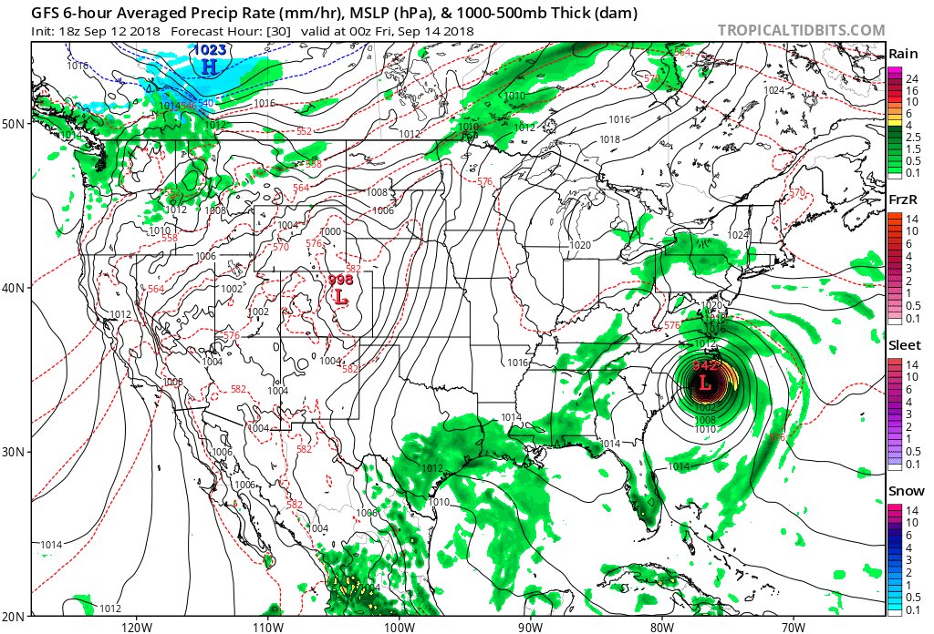
18Z WED and new 00Z THU Op. GFS similar. Models are trending more NW and faster with #Florence, and sat. imagery is indicating a ragged looking eye. Model run forecasts strong CAT 2 to make landfall near ILM early FRI then West over land. Don’t let down any guard, though, PLEASE.

Information coming in after the 18Z Wednesday models from 9/12/2018 were processed:
Fueling Florence (and, Concurrently, Eight Other Major Storms): Today’s #BradCast
Guest: Meteorologist Guy Walton (@climateguyw); Also: NH Primary results…
FULL STORY, LISTEN: http://bradblog.com/?p=12711
I will take whatever good news we can get and I see that shear and dry air has weakened #HurricaneFlorence to cat 3 115 mph. It is still not going away, but let’s hope this trend continues by time it gets closer to land #ThisIsGoodNews #SomeSeemDisappointed #DontPullForTheStom

Hurricanes are political. Wildfires are political. Climate change is political.
It’s a political choice to deny the science that connects these events.
It’s a political choice not to immediately build the world we need.
My interview w/ @washingtonpost: https://twitter.com/EricHolthaus/status/1040020953462464512
Still a lot of work to do on hurricane intensity forecasts. Just 24 hrs ago #Florence was supposed to be at 155 mph right now. I’m thrilled that eye looks ragged with 120 mph winds instead. Hard to see how it would get much stronger with way it looks now. pic.twitter.com/bBE7zTyTCe
— Bill Karins (@BillKarins) September 12, 2018
This interview @TheBradBlog show went well but was taped. After some edits it will initially be broadcast from 8-9 PM EDT this evening (Wednesday). Thanks to Brad many good subjects were covered. http://www.am950radio.com/events/the-bradcast-with-brad-friedman/ …

#Florence‘s strongest winds have weakened, but the hurricane is getting larger, so catastrophic rains and devastating storm surge are still a real threat to the Carolinas https://bit.ly/2x7j073
Hurricane Florence GFS model 10 day forecast 6 pm EST. A strong high pressure ridge coming off the N East coast dips down behind Florence from a low pressure trough in the E Central Atlantic & steers Florence NW and then NNW, strengthening with a landfall of a CAT 3 hurricane👇👇 pic.twitter.com/RACBMwRj3G
— Scott Cook (@scook2214) September 12, 2018
(As usual, this will be a fluid post in which more information gets added during the day as it crosses my radar, crediting all who have put it on-line.)
Great news folks. Models are trending more northwest and faster with #Florence and sat. imagery is indicating a ragged looking eye. If the system comes into Wilmington as a 2 and doesn’t stall people will be yelling the dreaded word “hype.” Don’t let down any guard though PLEASE.
Information coming in after the 12Z Wednesday models from 9/12/2018 were processed:
My interview @TheBradBlog show went well but was taped. After some edits it will initially be broadcast from 8-9 PM EDT this evening (Wednesday). Thanks to Brad many good subjects were covered. http://www.am950radio.com/events/the-bradcast-with-brad-friedman/ …

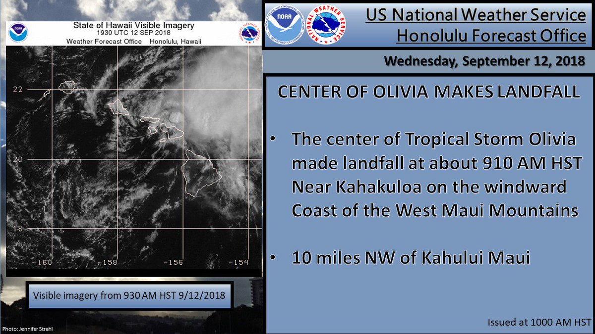
While all eyes were on #Florence, #Olivia made history today as the first tropical storm on record to ever make landfall on the island of Maui
“6 Years Ago, North Carolina Chose To Ignore Rising Sea Levels. This Week It Braces For Disaster” by @JenavieveHatch of @HuffPost: https://www.huffingtonpost.com/entry/north-carolina-sea-level-rise-hurricane-florence_us_5b985a87e4b0162f4731da0e
A #hurricane evacuation *to* #Florida. Can’t say I expected to type that phrase often in my career.

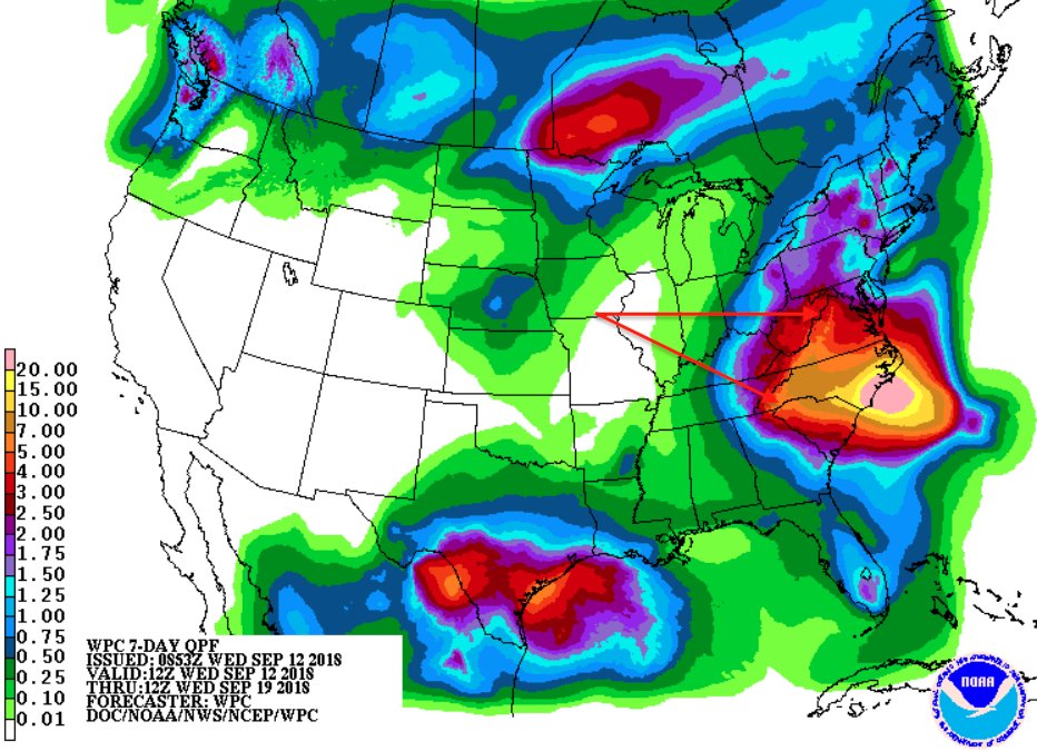
Attention is drawn to the coastal Carolinas, for good reason. But the rainfall potential for the Appalachians is also worrisome the first half of next week. The history of Appalachian #floods from tropical cyclone remnants is a long one. #Florence https://wxch.nl/2Nq2kRE
There’s virtually no precedent for a hurricane moving southwest for some time along the Carolina coast. Such an unorthodox track could produce some very unexpected outcomes, including a storm surge propagating from north to south.
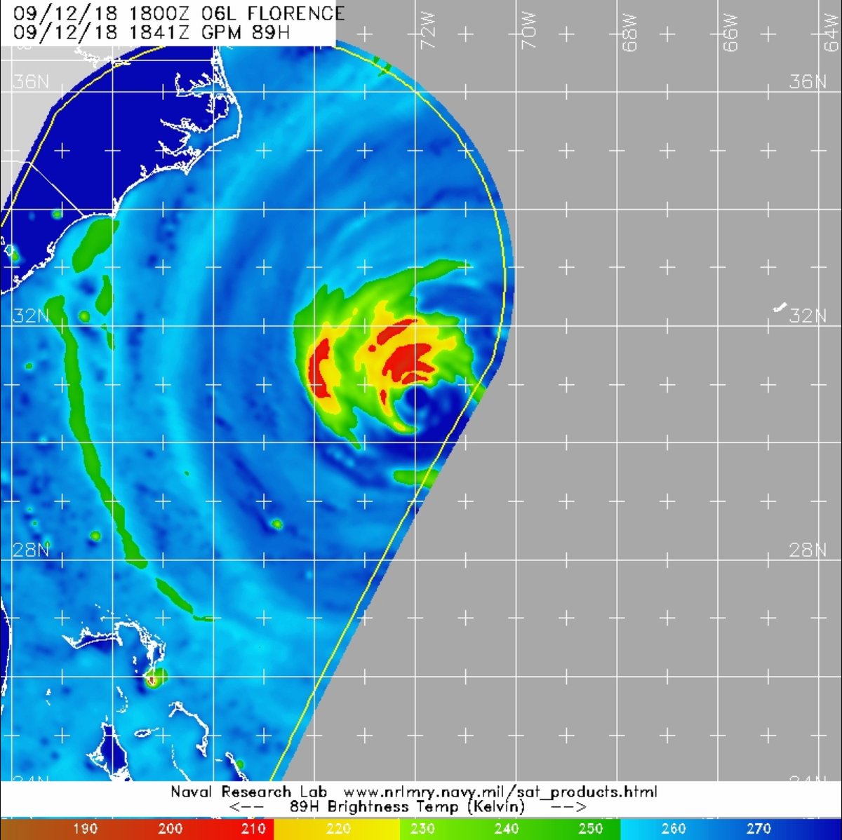
A recent 85GHz microwave pass over #Hurricane #Florence reveals despite its good IR presentation, the core is starting to degrade.
The earlier #ERC never finished & a combo of ocean upwelling & dry air entrainment are affecting the core.
Further intensification unlikely now.
Hurricane Florence ECMWF model 10 day forecast 12 pm EST. A strong high pressure ridge coming off the N East coast dips down behind Florence from a low pressure trough in the E Central Atlantic Steers Florence WNW. Another High pressure system blocks it's path to the North 👇👇 pic.twitter.com/B2GDoT2w29
— Scott Cook (@scook2214) September 12, 2018
We are starting to see good model consensus again for the eventual track of #Florence as of Wednesday afternoon 9/12/2018.
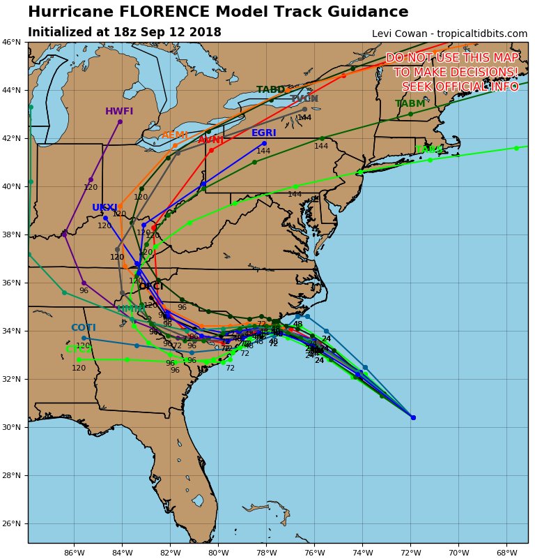
The remnants of Florence likely to impact our weather late weekend into early next week. I would call this a growing consensus with the track of Florence… #kywx
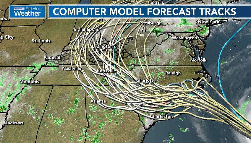
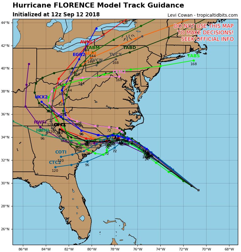
The oper. 12Z WED EURO bounces #HurricaneFlorence off the NC coast on FRI with the system moving southwest slowly to near Charleston before finally moving inland SUN. Thankfully, a slow weakening trend is in progress. A CAT 3 storm initially hitting the coast is still possible.
JUST IN: Georgia governor declares state of emergency ahead of Hurricane Florence http://hill.cm/Ca3yV9N
Hurricane Florence GFS model 10 day forecast 12pm EST. A strong high pressure ridge coming off the N East coast dips down behind Florence from a low pressure trough in the E Central Atlantic & steers Florence NW and then NNW, strengthening with a landfall of a CAT 4 hurricane👇👇 pic.twitter.com/5bgFJVst2E
— Scott Cook (@scook2214) September 12, 2018
Let’s get clear on this now: “Hurricanes are absolutely being affected by our changing climate,” says climate scientist @KHayhoe. #HurricaneFlorence @afreedma
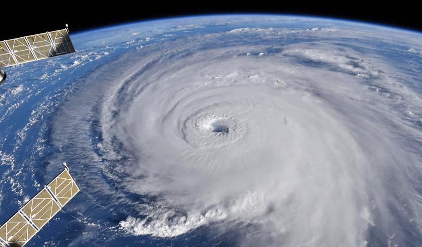
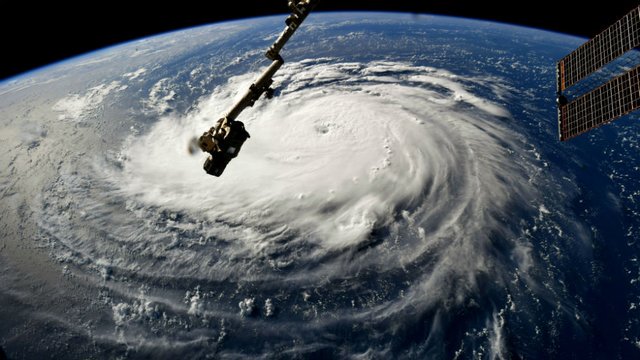
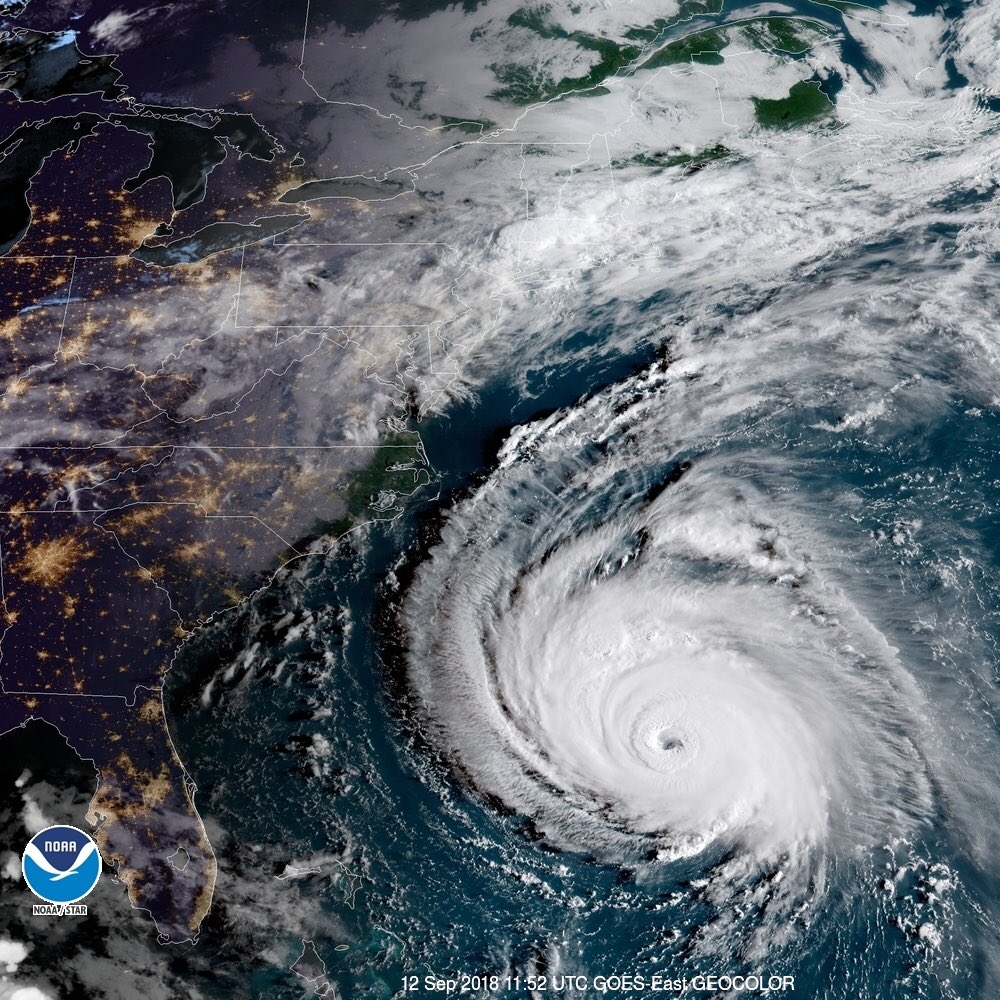
Afternoon visible satellite imagery of Hurricane #Florence. While the intensity is rather steady, the wind field keeps growing by the hour. This has impacts on the exact height of the storm surge. pic.twitter.com/4mdReVpHzx
— Matt Reagan (@ReaganMatt) September 12, 2018
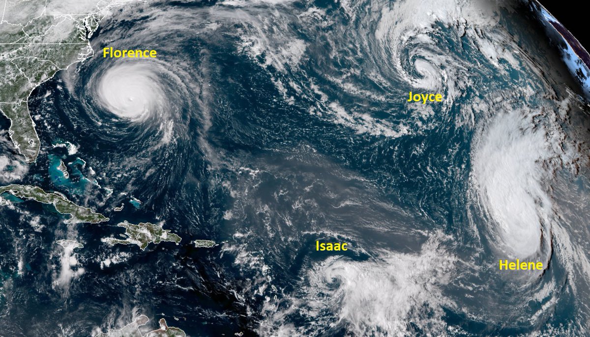
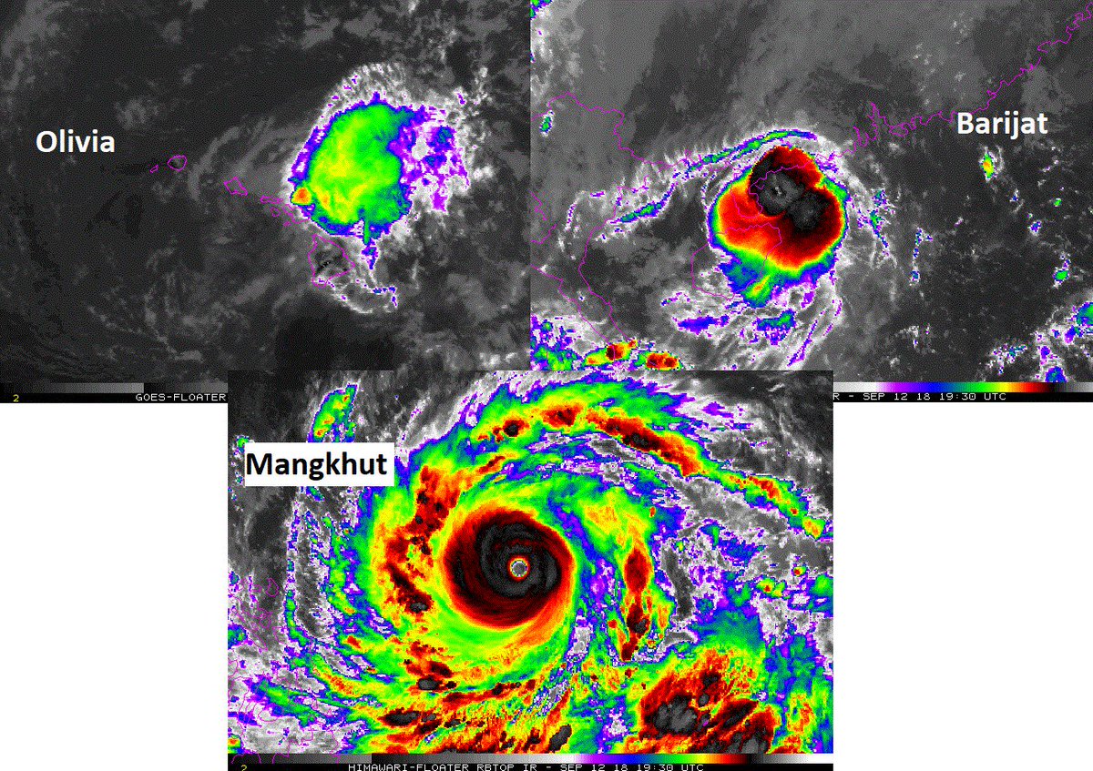
Cyclone explosion. 5 of 6 tropical storms/hurricanes/typhoons in N Hemisphere expected to hit land this week. Florence: Carolinas. Isaac: Lesser Antilles. Olivia: Hawaii. Mangkhut: Philippines. Barijat: China. Global activity (ACE): 159% of normal. More: https://wapo.st/2QouhrC

“North Carolina-sized hurricane makes its way to North Carolina”
https://grist.org/article/north-carolina-sized-hurricane-florence-makes-its-way-to-north-carolina/ …
12 WED GFS operational run stabs the North Carolina coast just north of Wilmington with #HurricaneFlorence at near CAT 4 strength early Friday but “more sanely” moves system slowly inland to the west similar to 06Z WED run. We will see if the 12Z WED EURO is similar.
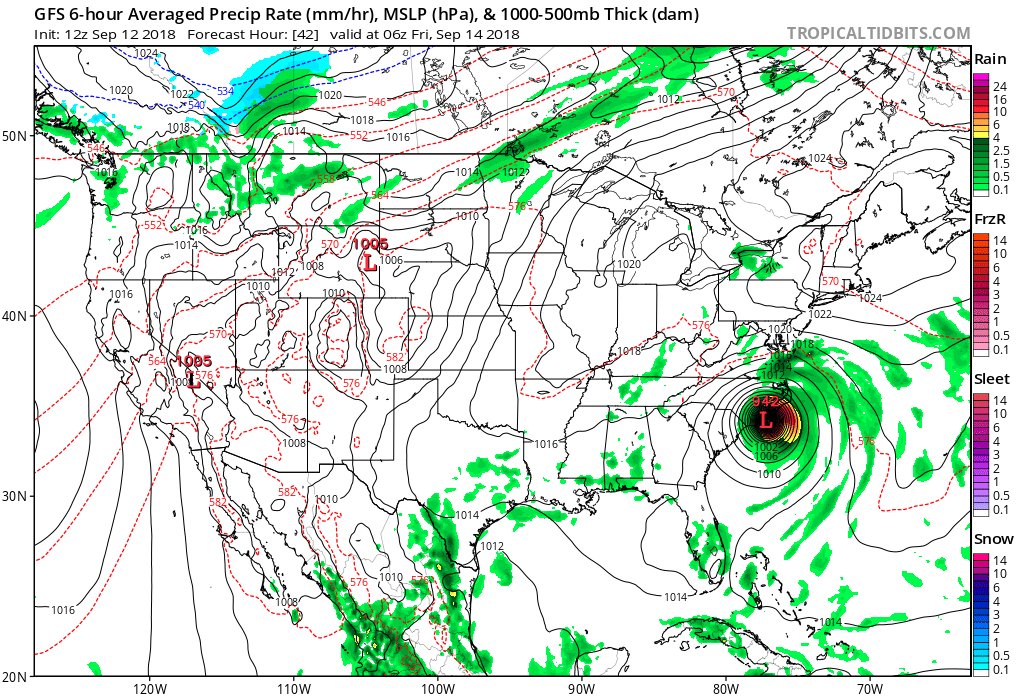
Information coming in after the 06Z Wednesday models from 9/12/2018 were processed:
Interesting work from Kossin (2018) in Nature: https://www.nature.com/articles/s41586-018-0158-3 … Slowdown in TC translation speed of 20% from 1946-2016 in N ATL for landfalling TCs. For flooding risk, this compounds and possibly even dominates increase in rainrates from enhanced water vapor content.
Strongest storms by basin in the satellite era, based on Advanced Dvorak (Satellite) Technique (Velden et al 2017). This method allows Gilbert to nudge out Allen and Wilma for strongest in the Gulf/Caribbean.

Most #HurricanceFlorence guidance this morning does not stall the system offshore this morning turning the hurricane west not southwest into inland South Carolina.
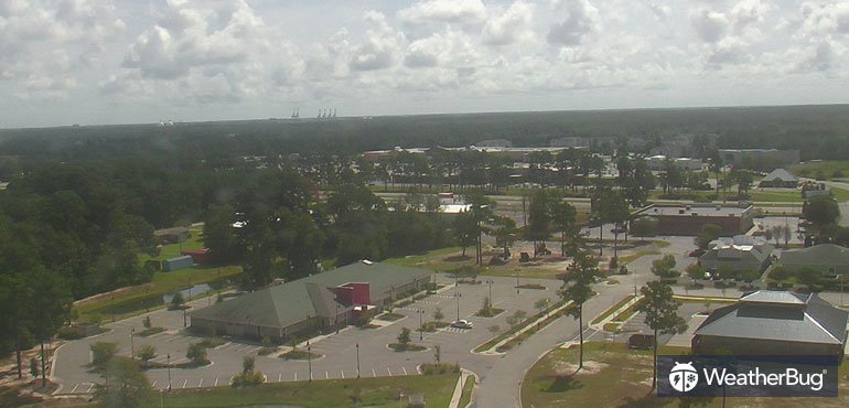
The “calm” before #Florence can be seen on our Wilmington, N.C. camera. It is a hot midday to prepare, with mid-80s already at #lunchtime. Check out the view: http://ow.ly/UCee30lNbrR #ncwx #scwx
The new eye is becoming better defined as #HurricaneFlorence finishes its ongoing eyewall replacement cycle. This new eye is looking to be 2 degrees of longitude wide in diameter… or approximately 140 miles wide. Wow. pic.twitter.com/zYEfiISz5g
— Michael Ventrice (@MJVentrice) September 12, 2018
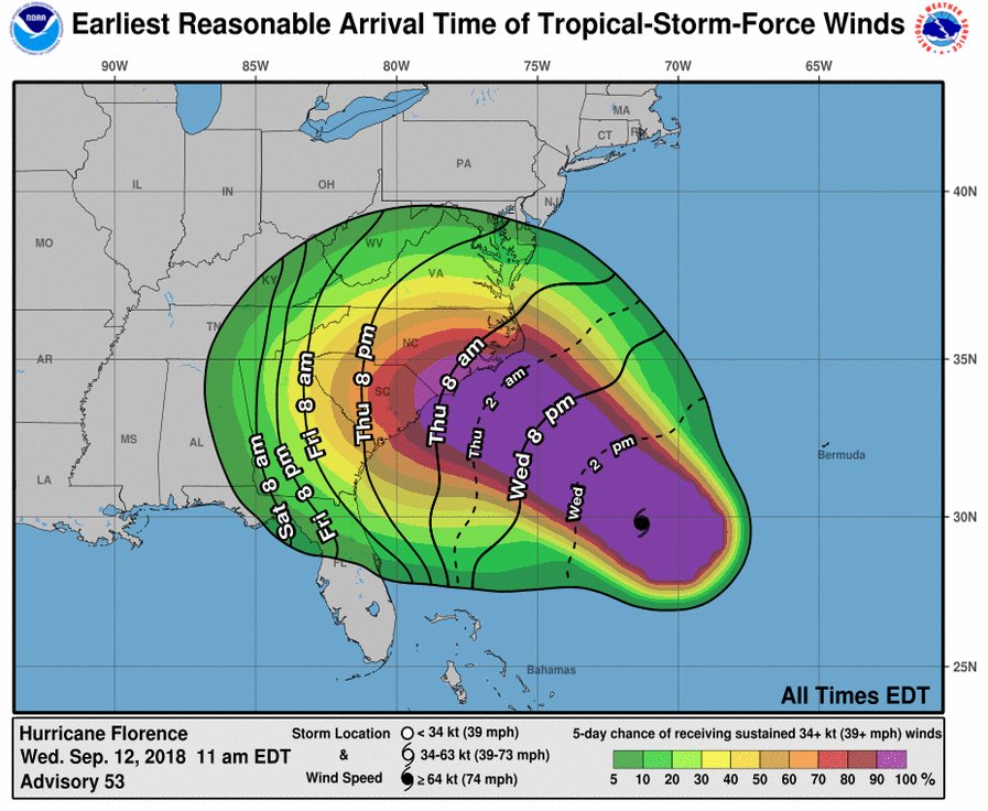
Arrival of #Florence winds on Thu will begin a slow process, like a plane that’s landed but sitting on tarmac waiting for an available gate, possibly one farther down the concourse than you thought. Finish preps before bed tonight, then be in the shelter you’ll stay in for days.
06 WED GFS operational run stabs the North Carolina coast just north of Wilmington with #HurricaneFlorence at near CAT 4 strength early Friday but “more sanely” moves system slowly inland to the northwest. After coastal destruction historic flooding would be main concern.

(If you like these posts and my work please contribute via the PayPal widget, which has recently been added to this site. Thanks in advance for any support.)
The Climate Guy


