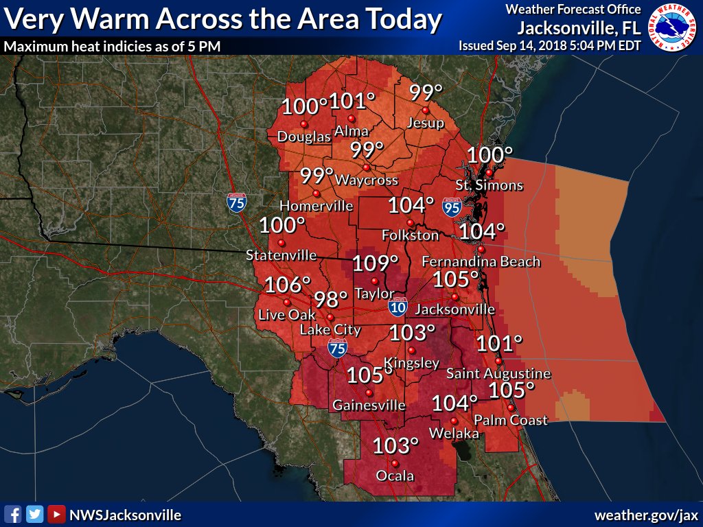
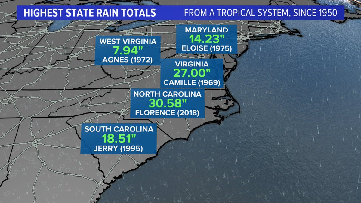
Saturday September 15th… Dear Diary. The main purpose of this ongoing post will be to track United States extreme or record temperatures related to climate change. Any reports I see of ETs will be listed below the main topic of the day. I’ll refer to extreme or record temperatures as ETs (not extraterrestrials)😊. Here is today’s main climate change related topic:
Tracking Florence Day Seven
Today will be the last day in which Florence is the main topic. Don’t you think that a week of tracking old Flo is enough?😉 Actually I will continue to add major news items in association with what is currently Tropical Storm Florence as it begins to move north Sunday through the upstate Carolina region and into the Northeast early this week, but we’ll move onto other topics. Florence on Saturday has moved into a “Harvey” phase crawling forward at no more than 5 mph due to very weak steering currents, a sign of climate change. The main problem through Sunday, like in Harvey when it reached this state inland, is one word…flooding, and like with Harvey over a wide area this will be catastrophic.
We have seen astounding amounts of rainfall , so far, from Florence, due to relentless rain bands:
Mesmerizing & horrifying — relentless intense rainbands NE of the center of slow-moving #Florence (just like with #Harvey https://t.co/330cAb8U32). 48-hour radar loop starting w/arrival of the rain on Thursday, and with many hours yet to come. #ncwx pic.twitter.com/KusrWMumTl
— Stu Ostro (@StuOstro) September 15, 2018
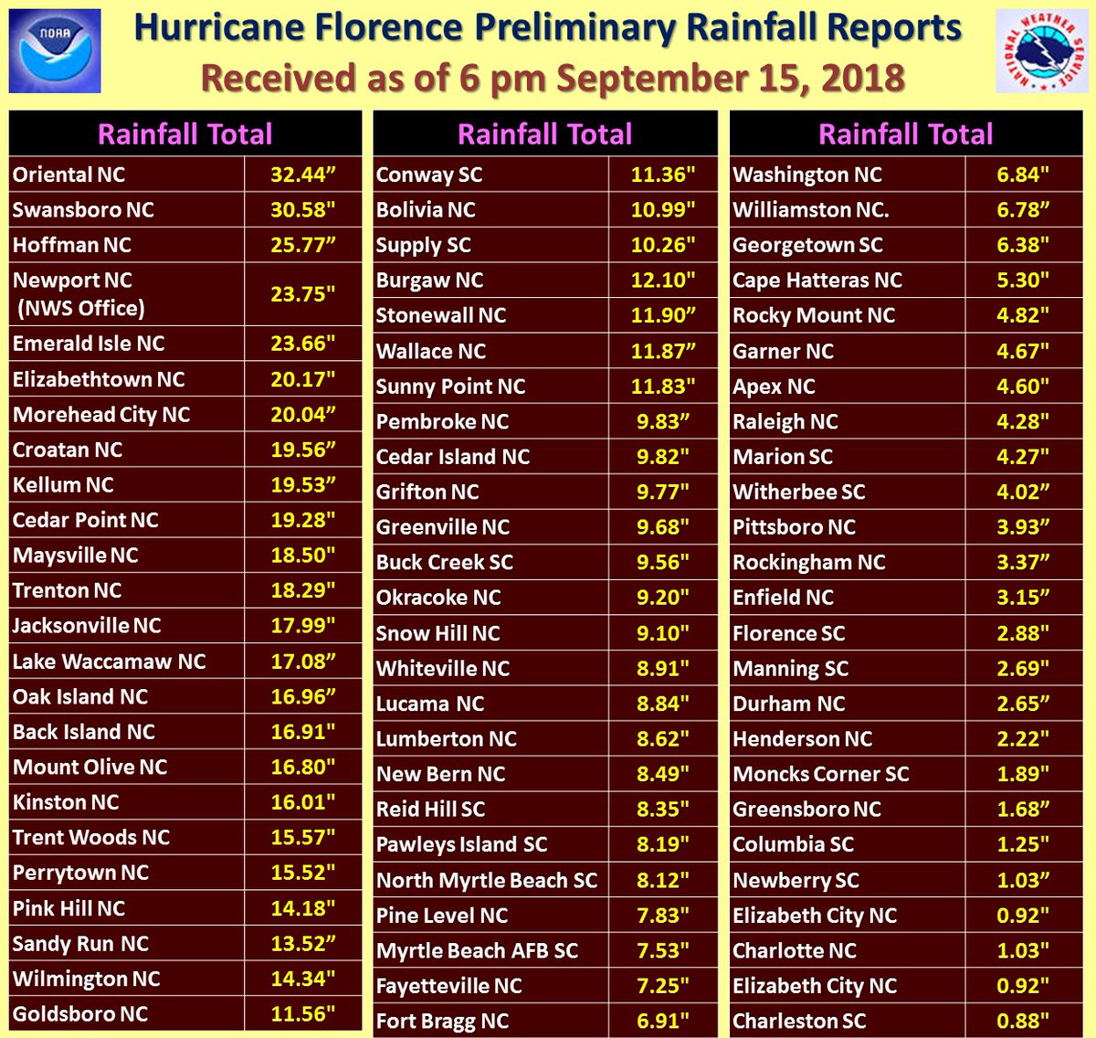
Updated preliminary rainfall reports from Florence received as of 6 pm Saturday evening. With Tropical Storm Florence still crawling slowly to the west at 2 mph, many of these areas will see more heavy rain overnight, further exacerbating the very serious ongoing flooding.
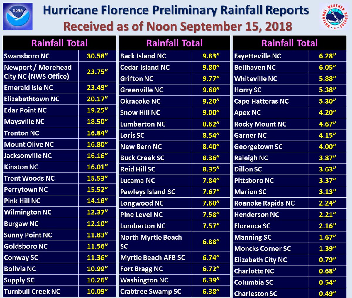
Updated preliminary rainfall reports from Florence received as of noon Saturday. Heavy rain continues in many of these areas.

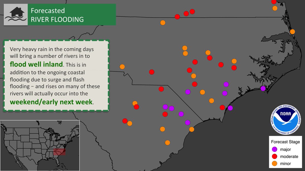
This storm will be a marathon vs. a sprint. In addition to the ongoing, dangerous storm surge and flash flooding, will be a long-term river flood threat WELL INLAND as very heavy rainfall continues to fall in the coming days. Consult http://weather.gov for the latest.
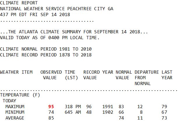
Little #climate nugget for tonight. Due to hot subsidence on west side of #Florence circulation #Atlanta reached 95F…the warmest reading here since 8/18/2016. We’ve had a couple of mild summers in #hotlanta.
Two high temperature records set today. St. Simons Island tied the record of 95 degrees previously set in 1950. Gainesville also tied the record of 96 degrees, previously set in 1952. #flwx #gawx #climate
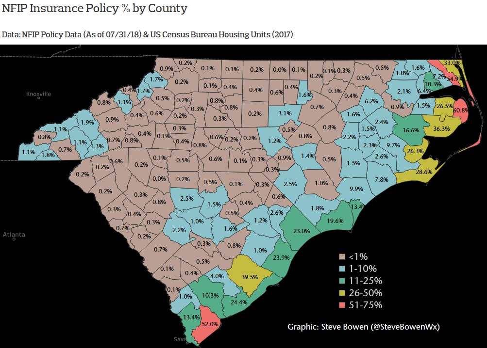
Quickly growing swath of North Carolina that has received at least 20″ of rain — per Doppler radar estimates. Very concerning since most inland counties have less than 5% of homes with NFIP flood insurance. #Florence
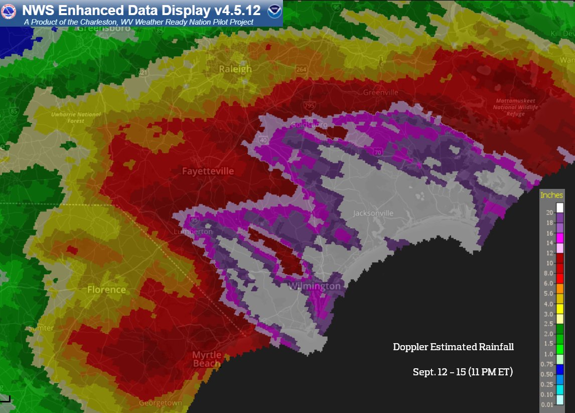
[Sat PM Update] The latest on Florence rainfall & flash flooding. Radar est. totals show pockets of 20-30″ with isolated reports greater than 30″. The flash flood risk will continue Sun into western NC & southwest VA where catastrophic flooding and river flooding are likely.
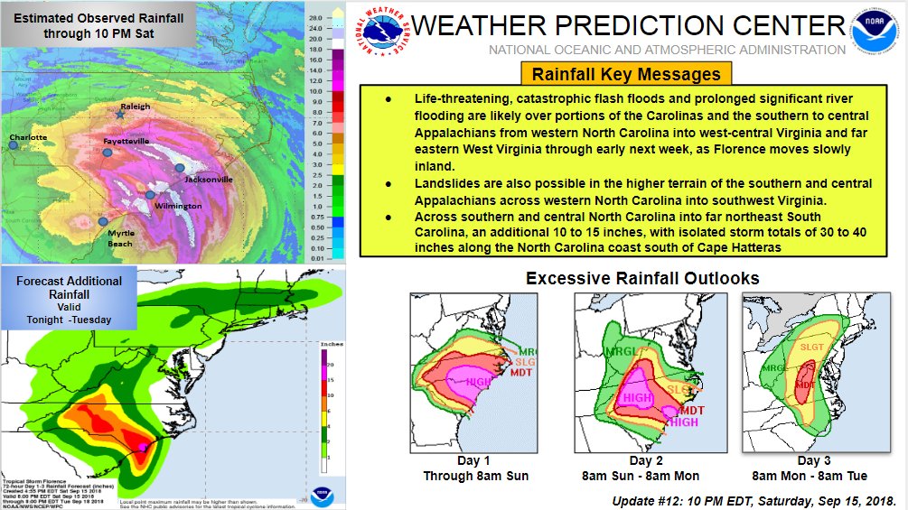
BREAKING: 14 Dead, Nearly A Million w/out Power: #Florence sweeps deeper into NC & DAYS of flooding lie ahead http://ow.ly/ZtaY30lPW64 via @newsobserver
@CharlesMunn1 @ChuckBell4 @DZA13 @afaduln2 @SusanDV @Spartan2dn @Sbuttsie @sbhendershot @waltb31 @climateguyw @rag772
Note: Greg Carbin is chief of the Forecast Operations Branch of the NOAA/NWS Weather Prediction Center, so these strong words are backed up by serious expertise.
The jury’s in and sentence isn’t good: an additional foot of rain is en route to much of #NorthCarolina thanks to Tropical Rainstorm #Florence. This could be North Carolina’s Harvey. 30-45” total.These climate-enhanced rainstorms are and will continue to become the new normal.
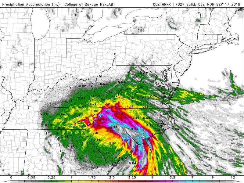
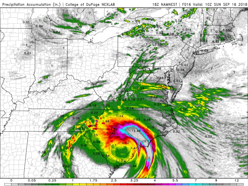
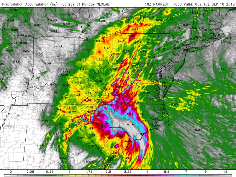
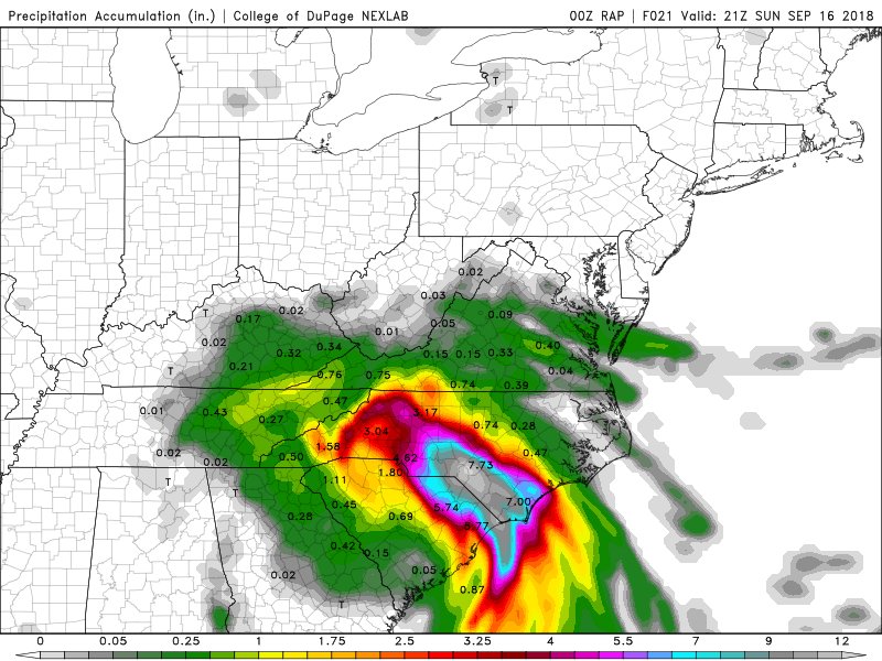
Tomorrow, the convergent zone moves on, aligns with the Appalachians.
We add more convergence, mountain focus, orographic lift, upslope enhancement… and this is going to become a nightmare in the mountains and also down stream of course, prior heavy rain, then more runoff.

Major networks now breaking in on Florence coverage. I think they are finally figuring out how big of a story this is. 30+ inches and more to come. 13 deaths and this sadly likely increases (praying it wont). Towns completely flooded. It is still in the beginning to middle stages
CRAWLING. Tropical Storm #Florence is moving at 2 mph. That’s SLOWER than the average walking pace of a person, which is 3.1 mph.
This near stall means no end anytime soon to the life-threatening flash flooding. #NCwx #SCwx
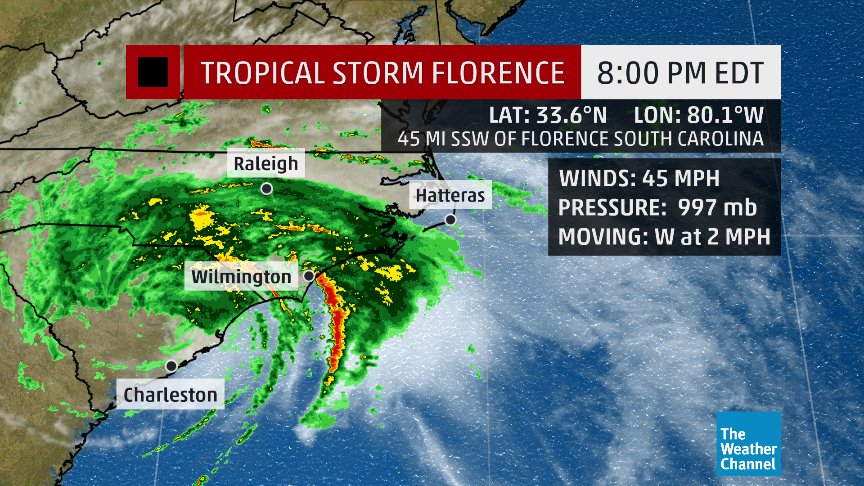
 Alex LamersVerified account@AlexJLamers

 Bernadette Woods P.@BernadetteWoods
Took a little longer than expected as per last night’s tweeted observations but the process is now unfolding and here comes that next stage of prolific rainfall production. Going to be a VERY long night.
.
Latest Blog from this AM:
http://www.stormhamster.com/entry/e091518.htm…
.

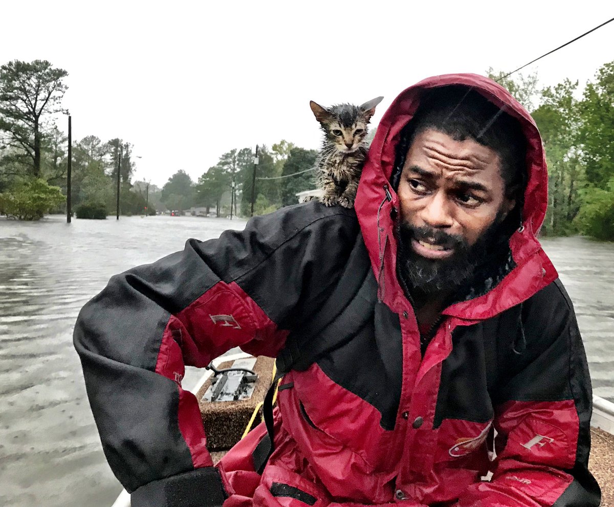
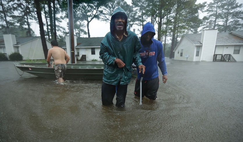
Meet Robert Simmons. Was stuck in his house since last night, when floodwaters began to rise in New Bern. A boat came and rescued him just now. He was sad to leave his father but left with his kitten hugging his neck. Cat’s name: Survivor, Simmons said. #HurricaneFlorence2018
Heard of deer swimming in flood water in Jacksonville,NC! This is real, we have video if it too on @weatherchannel !!!!!
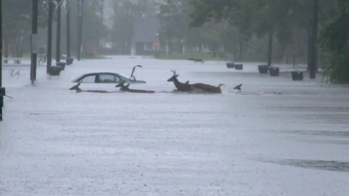
Florence has shattered all rainfall records for the Carolinas. It’s dumping 18 trillion gallons of water–as much water as there is in all of Chesapeake Bay
Jacksonville NC area continues to take brunt of nastiest band aimed onshore to east of center of #Florence… tornado warning, flash flood emergencies.
.@NCDOT_Trogdon: Conditions across southern & eastern NC continue to worsen. Highway closings have happened. Highway Patrol is assessing detour routes now. Numerous counties have several primary roads closed. 60 total primary roads have been closed. Clearing of debris is underway
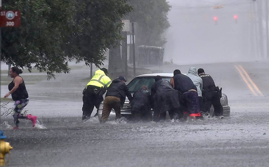
.@NC_Governor Cooper: The flood danger from storm is more immediate today than when it made landfall 24 hrs ago. We face walls of water. More ppl now face a threat than when the storm was offshore. Flood waters are rising, & if you aren’t watching for them, you are risking life.
.@NC_Governor Cooper: 5 deaths have been reported related to the storm and more are being investigated. Loss of life is heartbreaking. Every hour, first responders are preventing more deaths.
More than 30″ of rain has fallen from #Florence–and it’s still raining–as flood concerns expand west through the Carolinas. Perspective from @JamesBelanger: https://bit.ly/2MyMsYL
(If you like these posts and my work please contribute via the PayPal widget, which has recently been added to this site. Thanks in advance for any support.)
The Climate Guy


