The main purpose of this ongoing blog will be to track planetary extreme or record temperatures related to climate change. Any reports I see of ETs will be listed below the main topic of the day. I’ll refer to extreme or record temperatures as ETs (not extraterrestrials)😉
Main Topic: How Much Will Henri Be Affected By Climate Change?
Dear Diary. Last night I made the following forecast pronouncement:
Given that Henri is likely heading into New England by Sunday, it will likely cause millions if not billions of dollars in damage. Hopefully, people will head National Hurricane Center and local warnings so there won’t be any loss of life.
Since we don’t live on two identical planets with one not affected by industrial carbon pollution, we can’t precisely answer today’s main topic question, but we can notice a few hints that extra CO2 will make Henri worse.
First, most remember Sandy from 2012, which was the last extreme tropical event in the Northeast raking up billions in damage. Sandy made landfall in northern New Jersey as a CAT1 hurricane making a quick transition to an extra tropical cyclone. There were two quite obvious factors we as scientists could peg on Sandy linking the system to climate change. First, the path was extremely unusual for late October. Typically hurricanes that time of the year veer out to sea towards the Northeast . A strong heat dome or ridge aloft to Sandy’s northeast steered the system northwest towards New York, though. This warm ridge was a clear climate change marker at the time.
As far as Henri goes, it’s much earlier in the hurricane season, so the ridge blocking the system, though rare, won’t be extremely unusual. It’s this type of mechanism that has moved all historic systems going into the Northeast towards their final destination. Still, one has to wonder how much carbon pollution has affected the strong ridge northeast of Henri.
Second, waters along most of the path of Sandy were warmer than average, particularly near the Gulf Stream. Here is a good summary of climate change factors affecting Sandy from Wikipedia:
https://en.wikipedia.org/wiki/Hurricane_Sandy
Relation to global warming
See also: Tropical cyclones and climate change
According to NCAR senior climatologist Kevin E. Trenberth, “The answer to the oft-asked question of whether an event is caused by climate change is that it is the wrong question. All weather events are affected by climate change because the environment in which they occur is warmer and moister than it used to be.”[36] Although NOAA meteorologist Martin Hoerling attributes Sandy to “little more than the coincidental alignment of a tropical storm with an extratropical storm”,[37] Trenberth does agree that the storm was caused by “natural variability” but adds that it was “enhanced by global warming”.[38] One factor contributing to the storm’s strength was abnormally warm sea surface temperatures offshore the East Coast of the United States—more than 3 °C (5 °F) above normal, to which global warming had contributed 0.6 °C (1 °F).[38] As the temperature of the atmosphere increases, the capacity to hold water increases, leading to stronger storms and higher rainfall amounts.[38]
As they move north, Atlantic hurricanes typically are forced east and out to sea by the Prevailing Westerlies.[39] In Sandy’s case, this typical pattern was blocked by a ridge of high pressure over Greenland resulting in a negative North Atlantic Oscillation, forming a kink in the jet stream, causing it to double back on itself off the East Coast. Sandy was caught up in this northwesterly flow.[39] The blocking pattern over Greenland also stalled an Arctic front which combined with the cyclone.[39] Mark Fischetti of Scientific American said that the jet stream’s unusual shape was caused by the melting of Arctic ice.[40] Trenberth said that while a negative North Atlantic Oscillation and a blocking anticyclone were in place, the null hypothesis remained that this was just the natural variability of weather.[37] Sea level at New York and along the New Jersey coast has increased by nearly a foot (300 mm) over the last hundred years,[41] which contributed to the storm surge.[42] Harvard geologist Daniel P. Schrag calls Hurricane Sandy’s 13-foot (4 m) storm surge an example of what will, by mid-century, be the “new norm on the Eastern seaboard”.[43]

The National Hurricane Center (NHC)’s forecast for the storm as of October 28, 2012
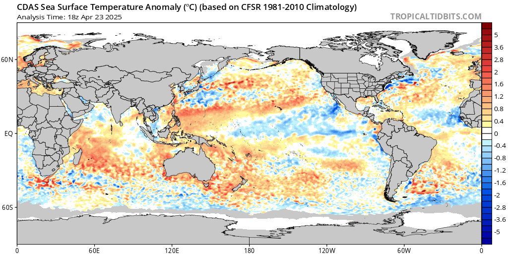
Fast forward nine years to 2021 and waters off the East Coast are even more anomalously warm. Don’t forget that it’s also August, so waters are typically at their peak temperature during any given year. This leads me worried that if Henri can quickly ramp up to a CAT2 on Saturday, the system won’t have a chance to wind down much on final approach Sunday. The wildcards in all of this will be unforeseen wind shear, which hopefully can weaken the system, and how slow the system will move on final approach.

Also:
In summary, we will be watching for rapid strengthening on Saturday and how much Henri can sustain itself on Sunday for climate change links. Also, please say a prayer for those living in the Northeast. They will need it.
A most important updated thought from Saturday:
Here are some “ET” reports from the last couple of days:
Here is more climate and weather news from Friday:
(As usual, this will be a fluid post in which more information gets added during the day as it crosses my radar, crediting all who have put it on-line. Items will be archived on this site for posterity. In most instances click on the pictures of each tweet to see each article. The most noteworthy items will be listed first.)
Now here are some of today’s articles and notes on the horrid COVID-19 pandemic:
(If you like these posts and my work please contribute via the PayPal widget, which has recently been added to this site. Thanks in advance for any support.)
Guy Walton “The Climate Guy”